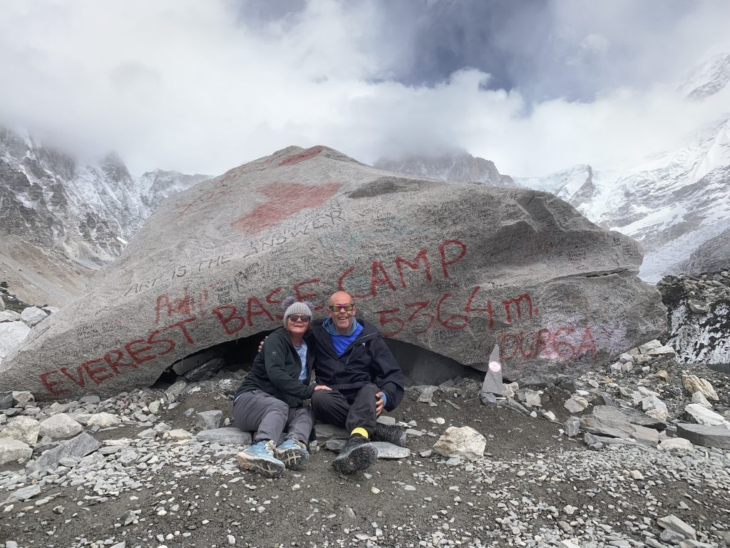
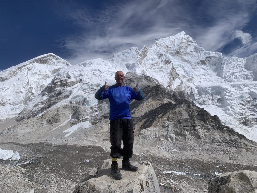
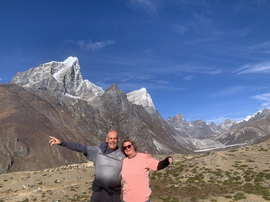
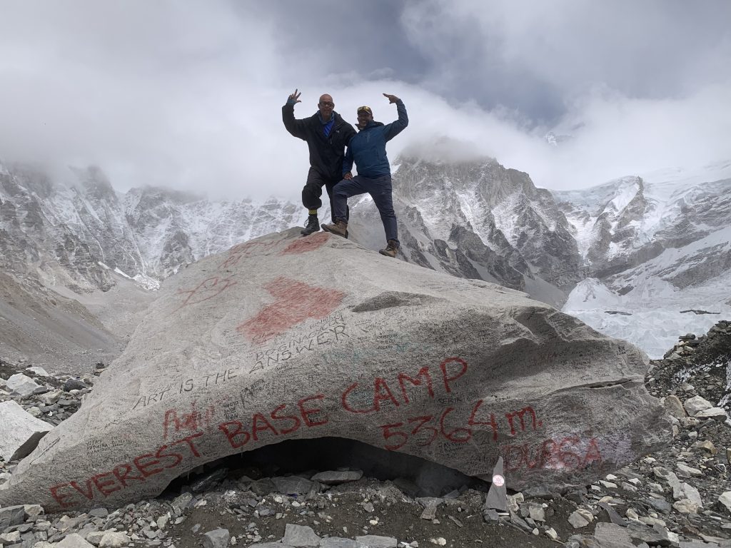
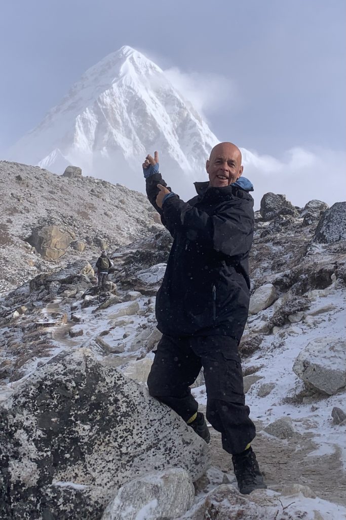
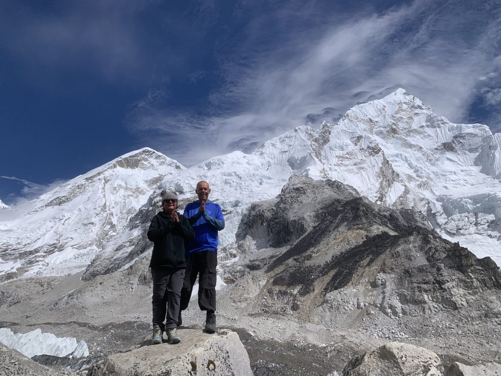
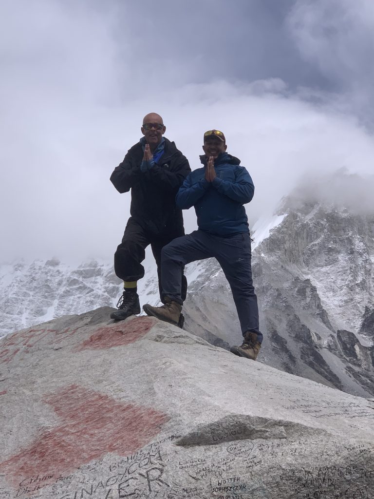
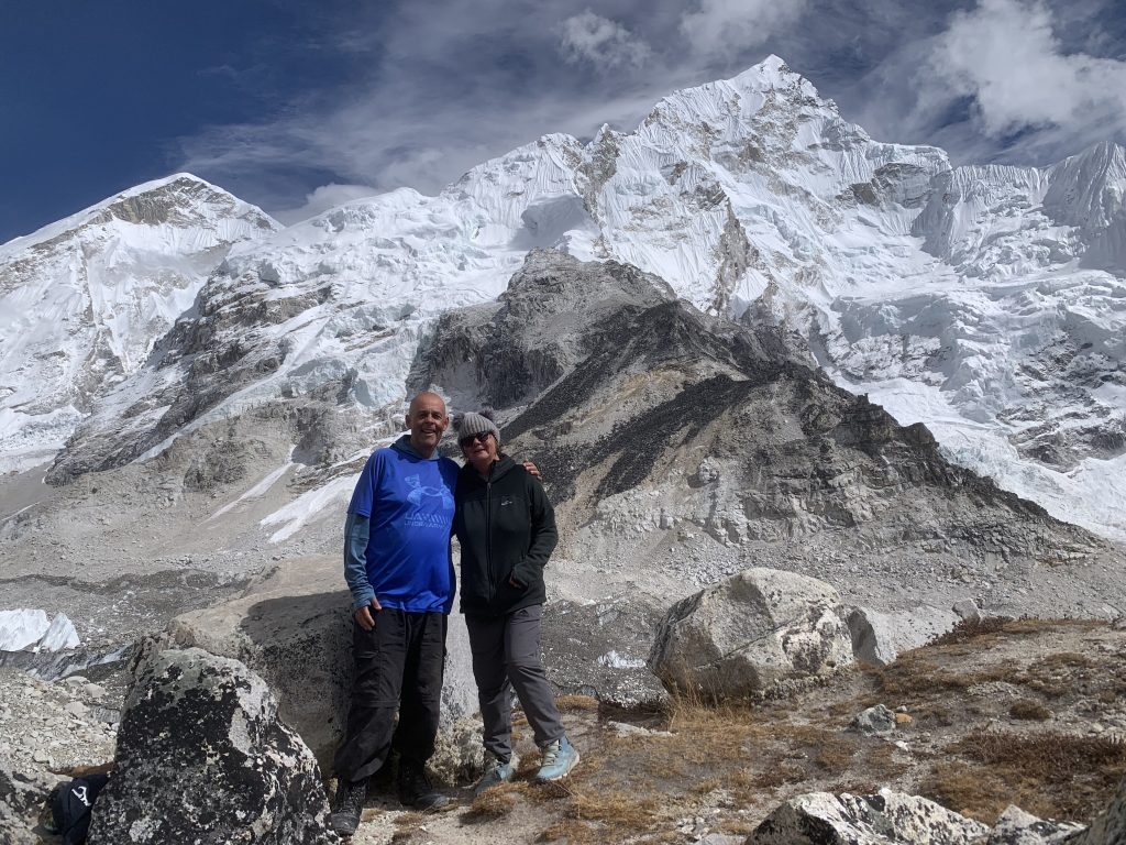
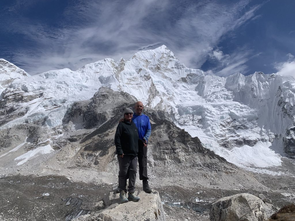
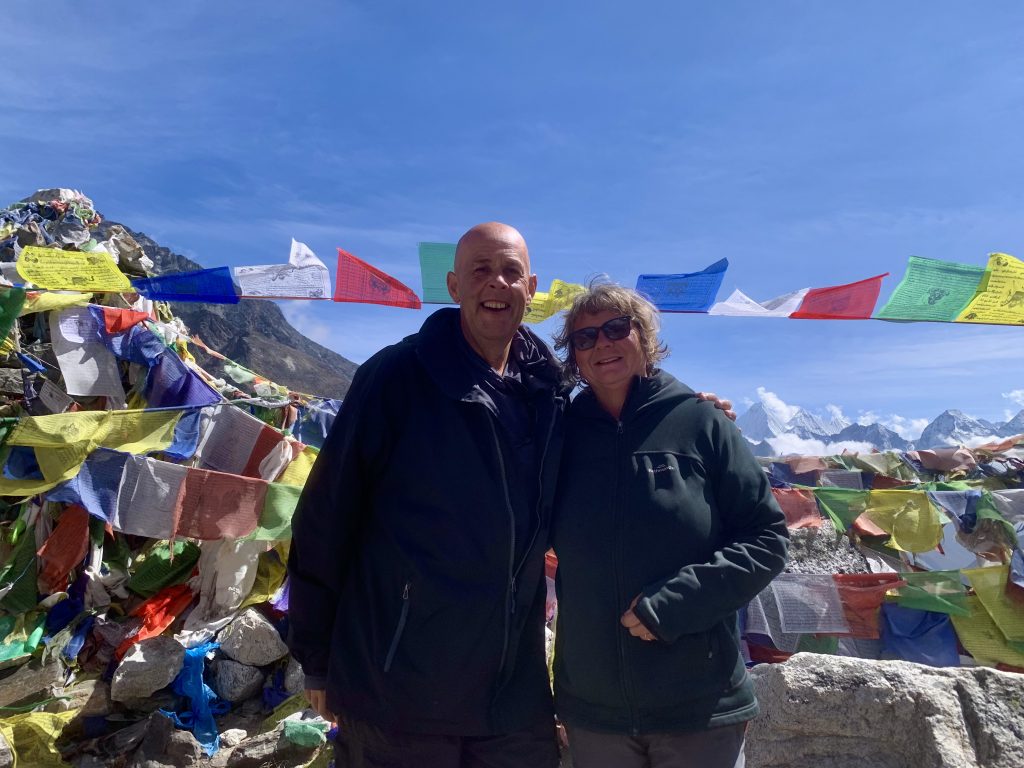
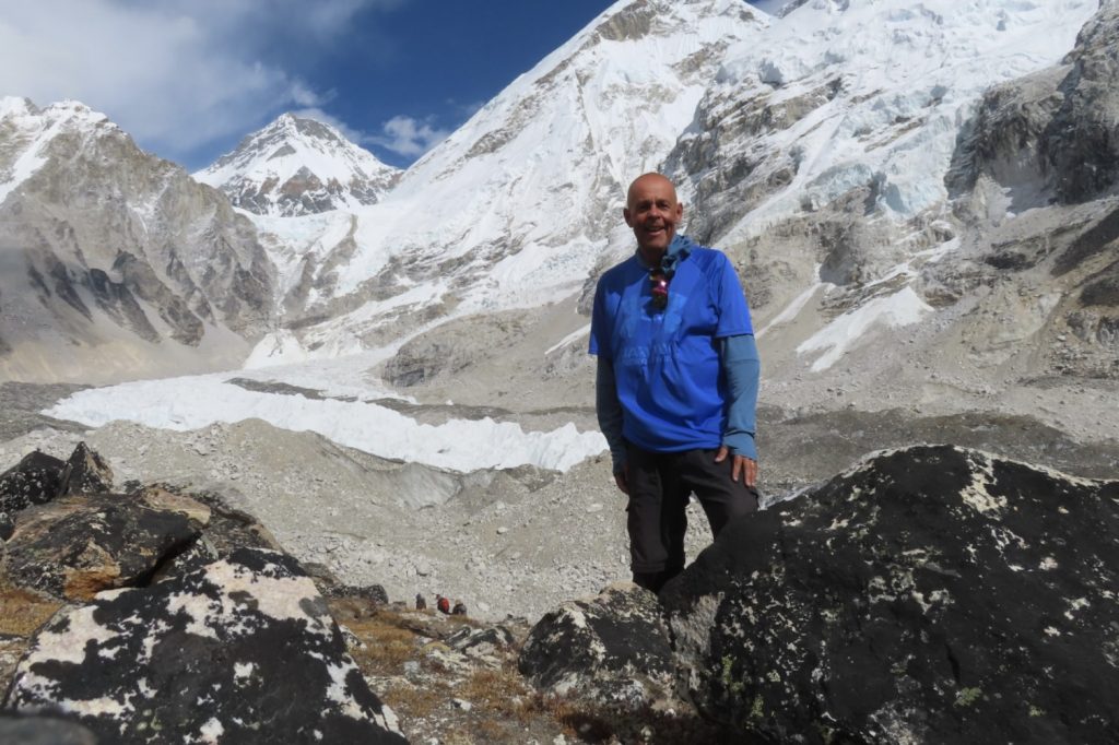
Big news is that we made it to Everest Base Camp – we hiked 141 kms and up to an altitude of 5,364 metres (or 17,598 feet)!!!
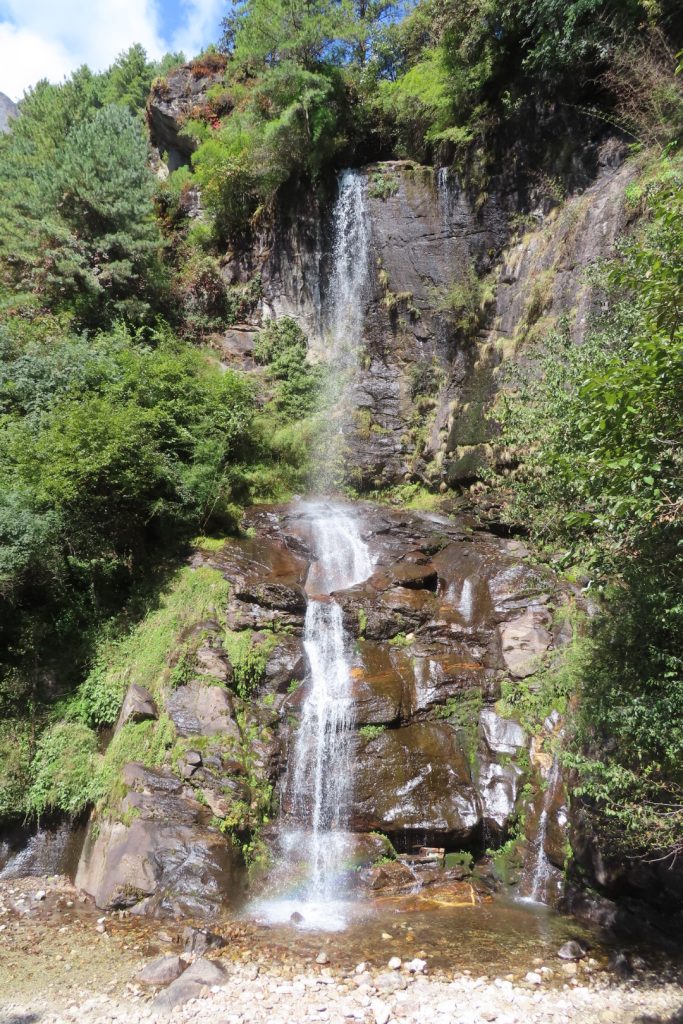
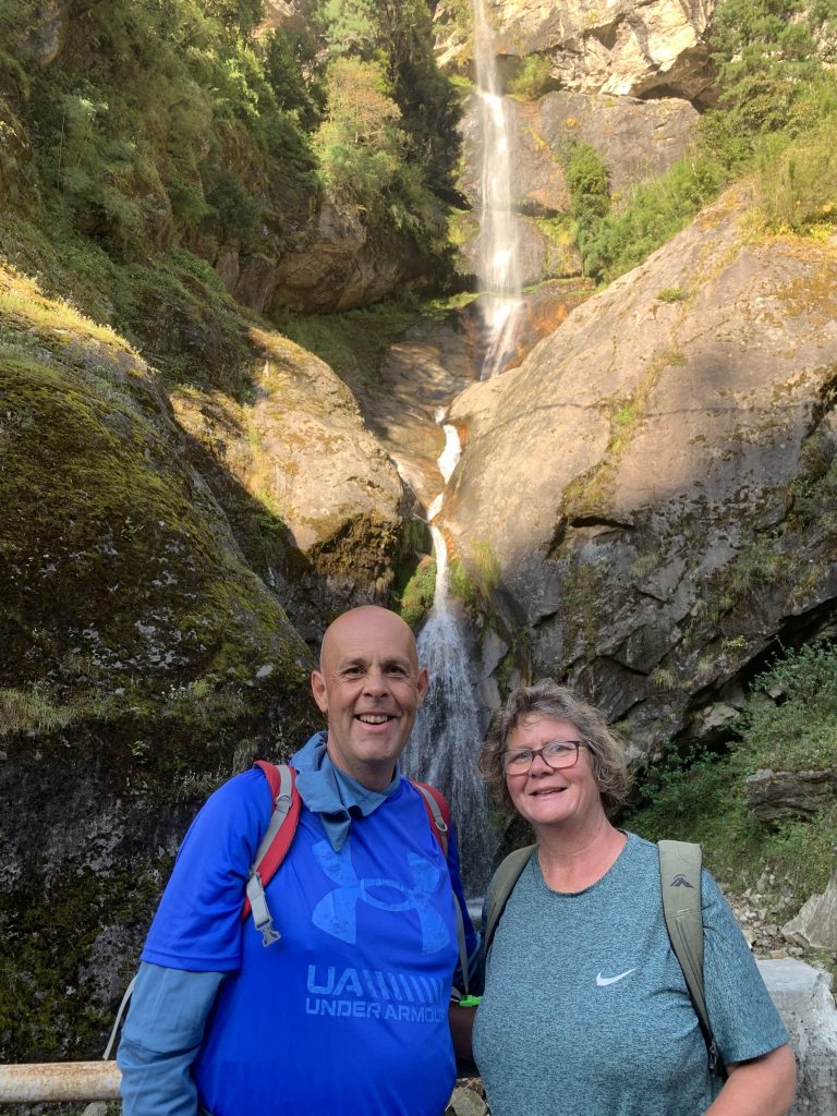
(We are aware of the number of photos in this blog update, but is was so stunning)
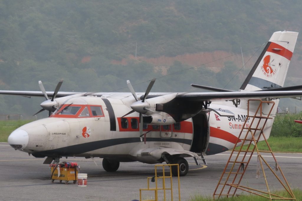
Well what a rollercoaster ride of a journey it’s been since our last update. On 10 October we left Kathmandu and we started our journey at 0130 in the morning to hike to Everest Base Camp. This would see us travel for 4 1/2 hours in the dark on some very sketchy roads to reach Ramechhap Airport (which is used during the busy hiking period). For 48 hours we were unable to fly into Lukla (Tenzing Edmund Hilary Airport) at 2,456 metres due to poor weather conditions. However the weather cleared on 12 October and we safely landed on a very short landing strip at Lukla (which is regarded as one of the most dangerous airports in the world) – which includes having a runway with a steep incline to slow the planes down before they hit the mountain!!
The impact of this delay meant adjustments needed to be made to our hiking schedule, that included losing both acclimatisation days – meaning 9 days hiking without a break.
Before describing our efforts, here are some stats::
- 141 kilometers hiked
- Reached an altitude of 5,364 metres
- Hiked more than 216,000 steps in 9 days
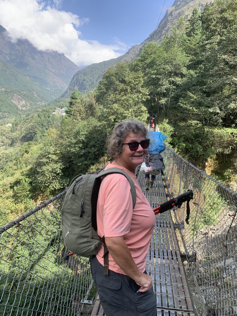
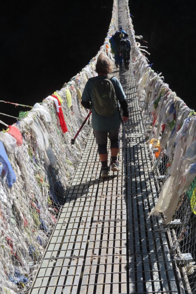
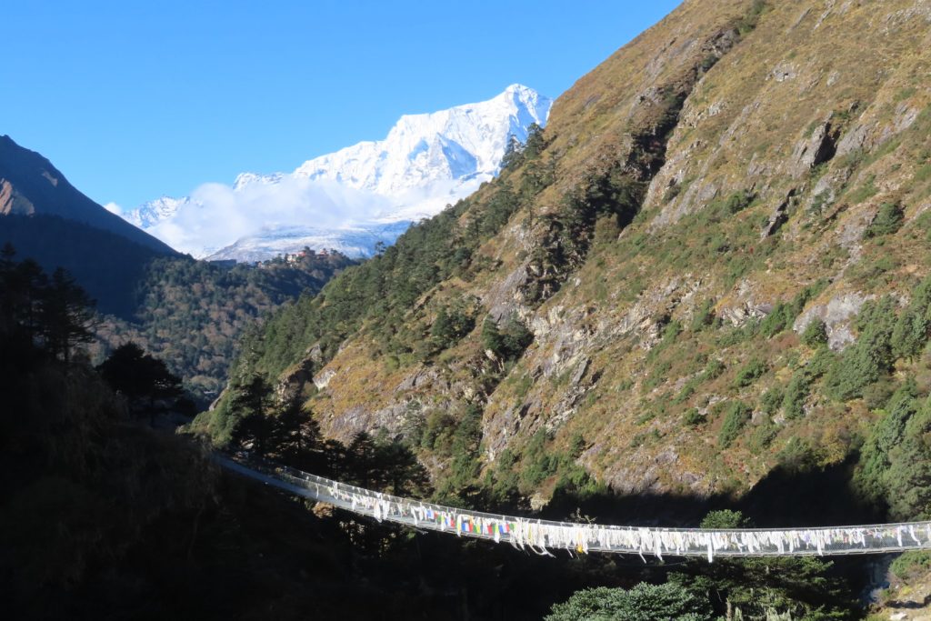
- 10 swing bridges crossed
- 2,900 metres in vertical altitude climbed from Lukla Airport to Everest Base Camp
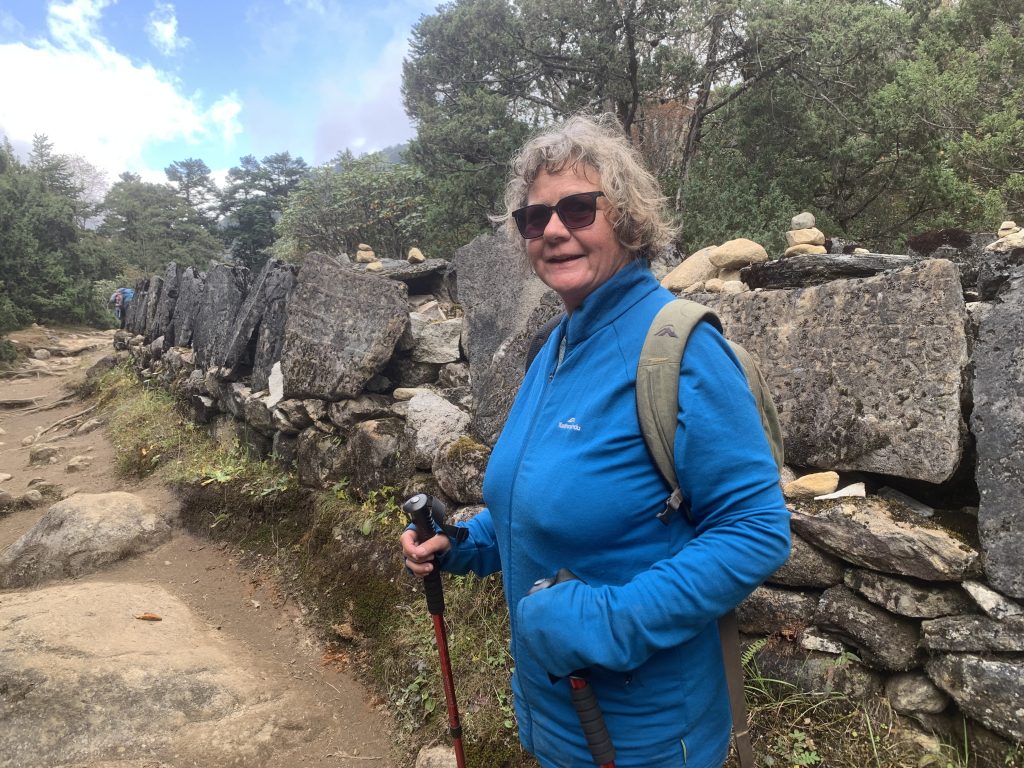
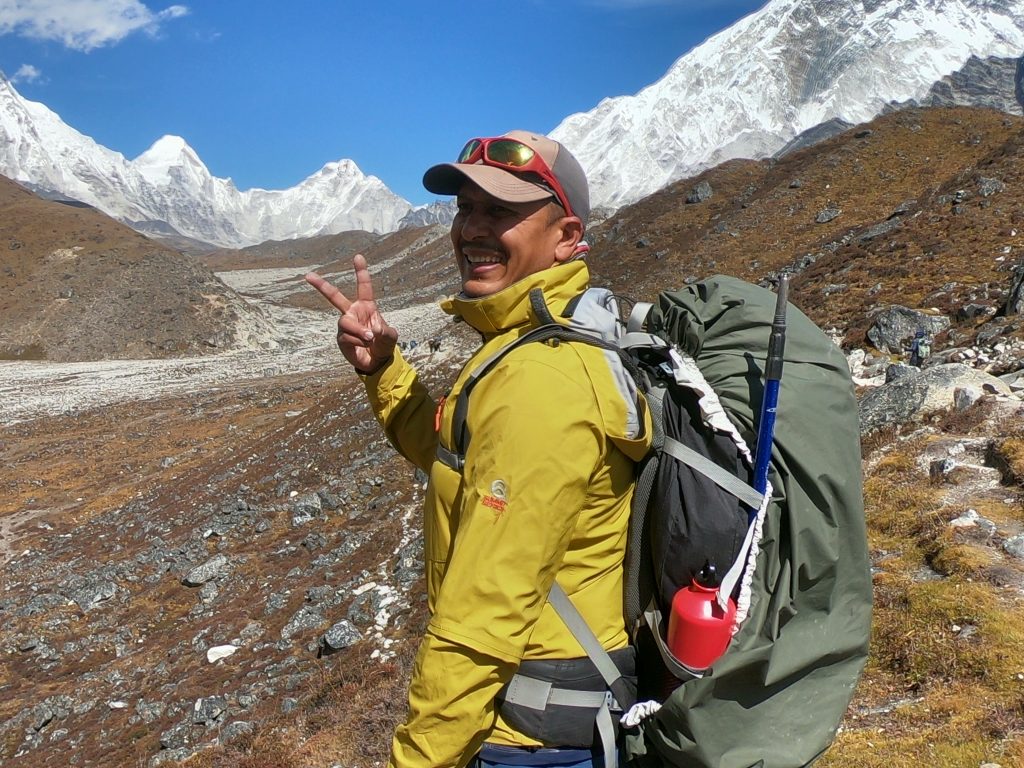
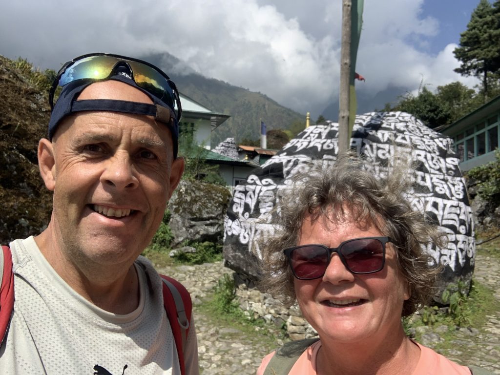
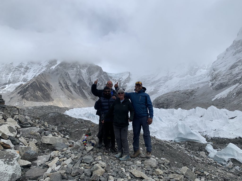
After safely landing, we grabbed breakfast, met our fantastic Porter (Dileep) and our amazing Guide (Sanjya – from Nepal Planet Treks and Expedition P. Ltd (5 star rating) and started Day 1 of our hike to Phakding which meant we covered 13.2 kms (20,401 steps) and dropped altitude by 246 metres to 2,246 metres. The accommodation on the hike over the coming days were in basic tea houses which are all ‘free of charge’, but you must eat and pay for food/drink instead – as you gain altitude the cost of these increases significantly as all goods are carried up by the locals. The accommodation is very basic, with heating in the dining area only (from 1700 ish) and no heating in the sleeping rooms.
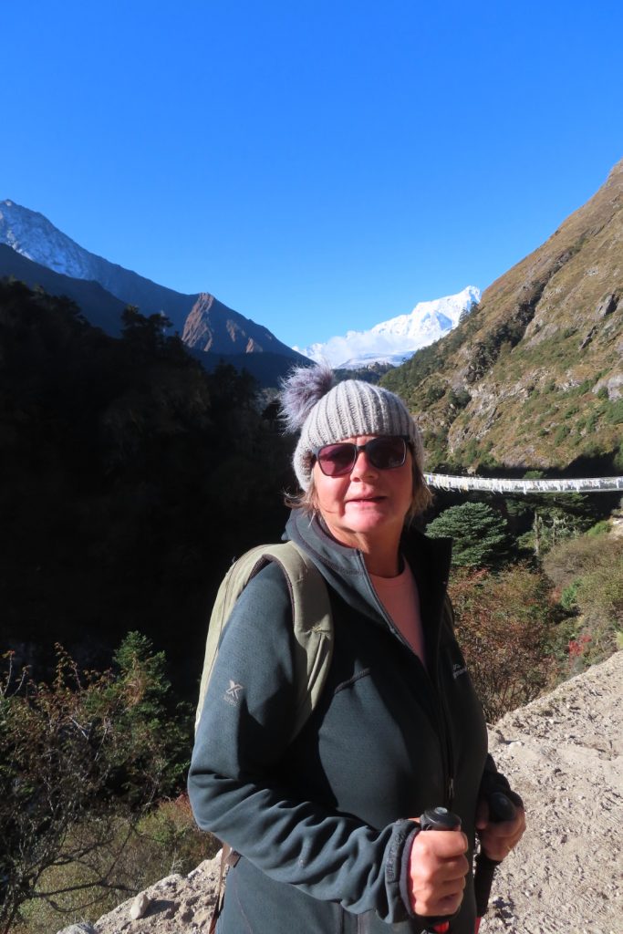
At 0700 we started Day 2 with us hiking what is known as ‘Nepalese Flat’ (lol) and crossing 5 swing bridges. After lunch we reached the major climb of the day of almost 1,200 metres, which lasted 3 hours and finished in the town of Namche – covering 12.4 kms (19,054 steps) and raising to an altitude of 3,440 metres..
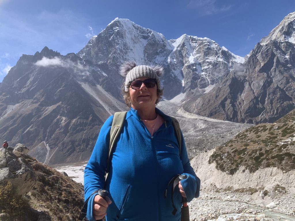
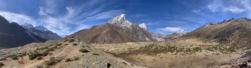
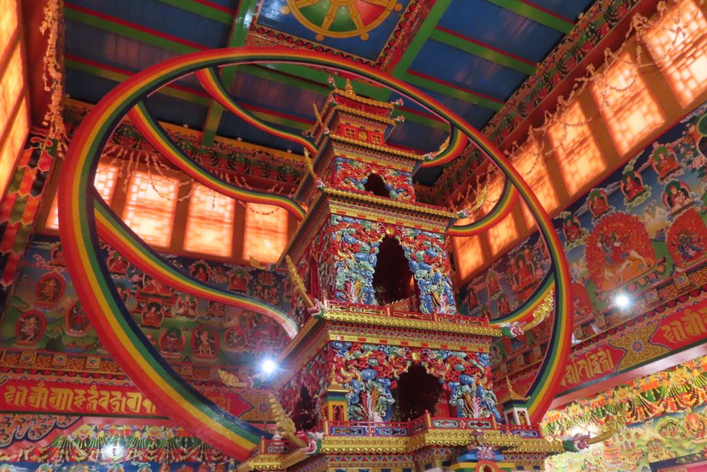
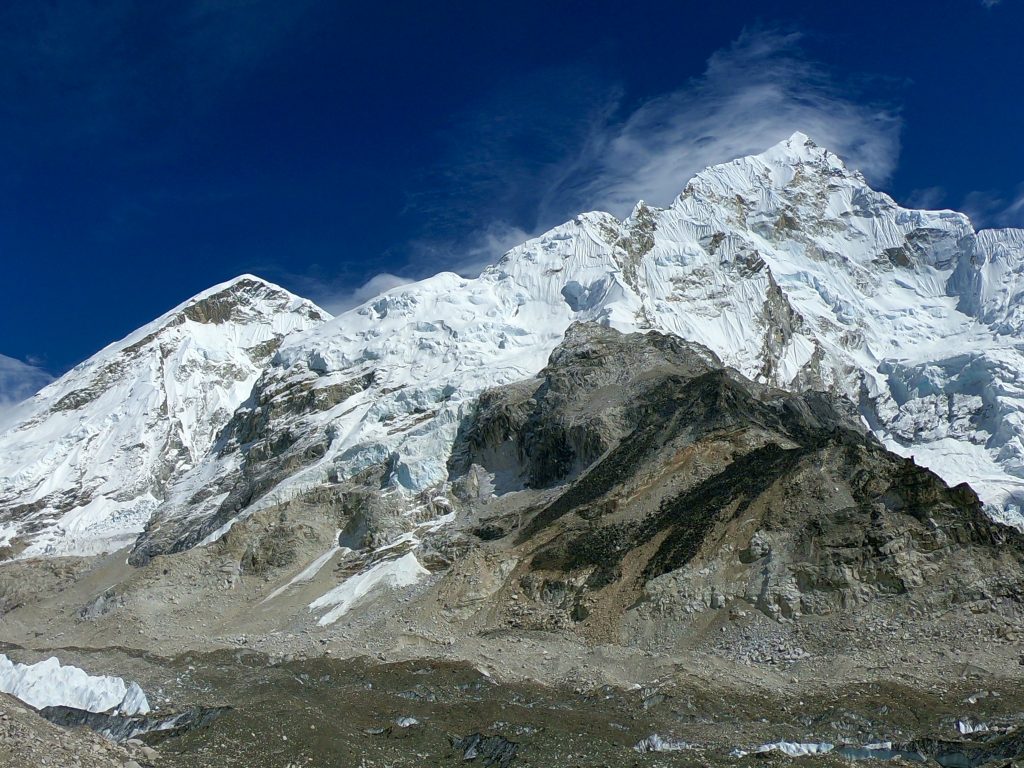
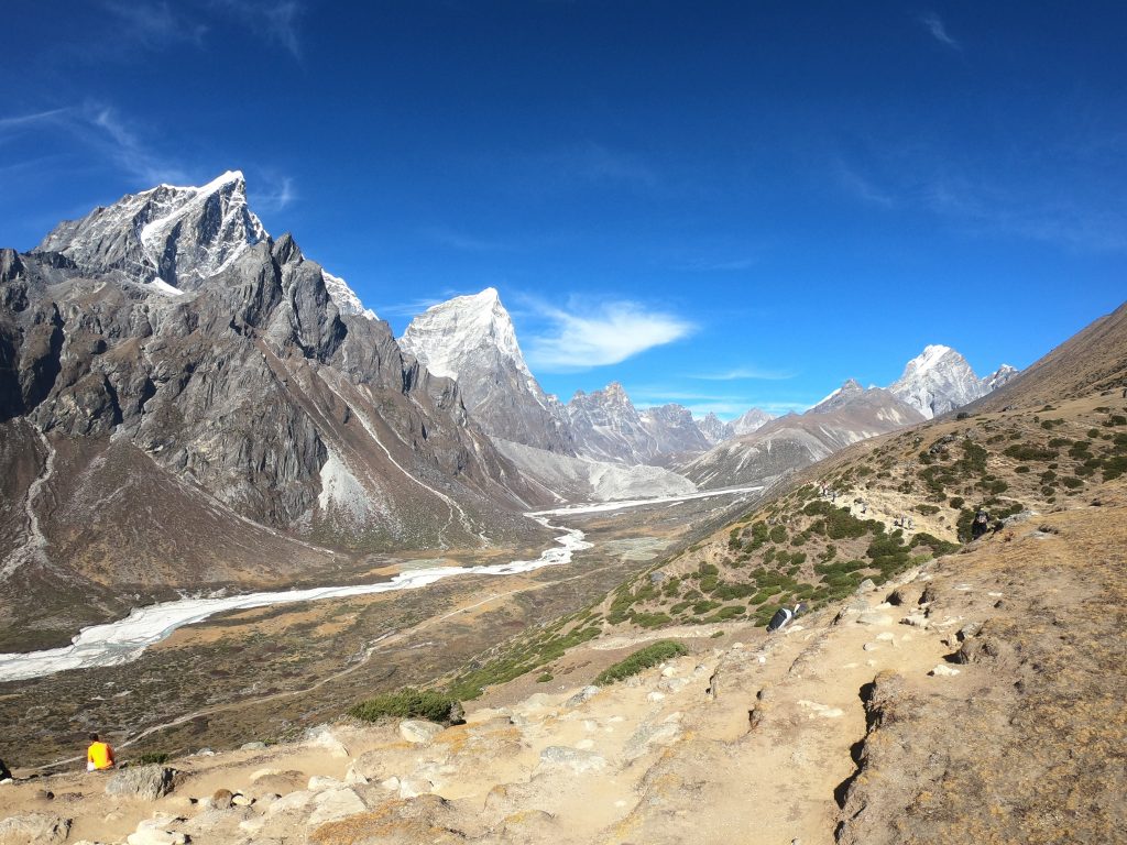
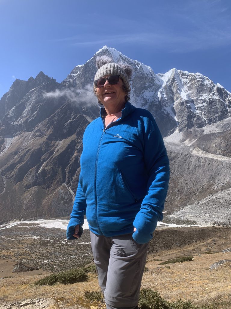
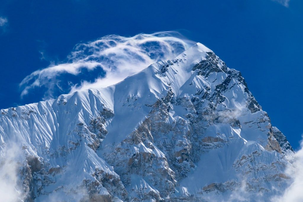
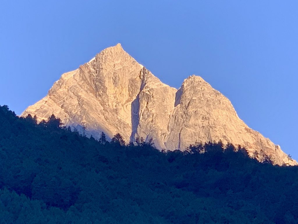
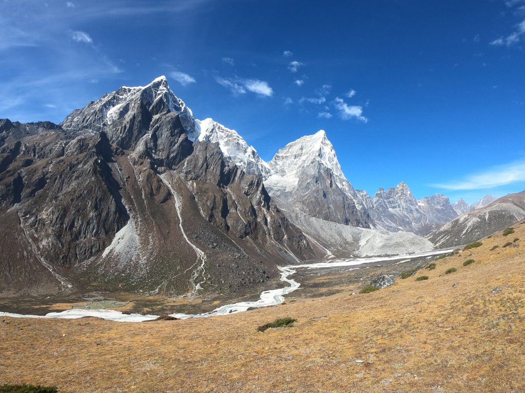
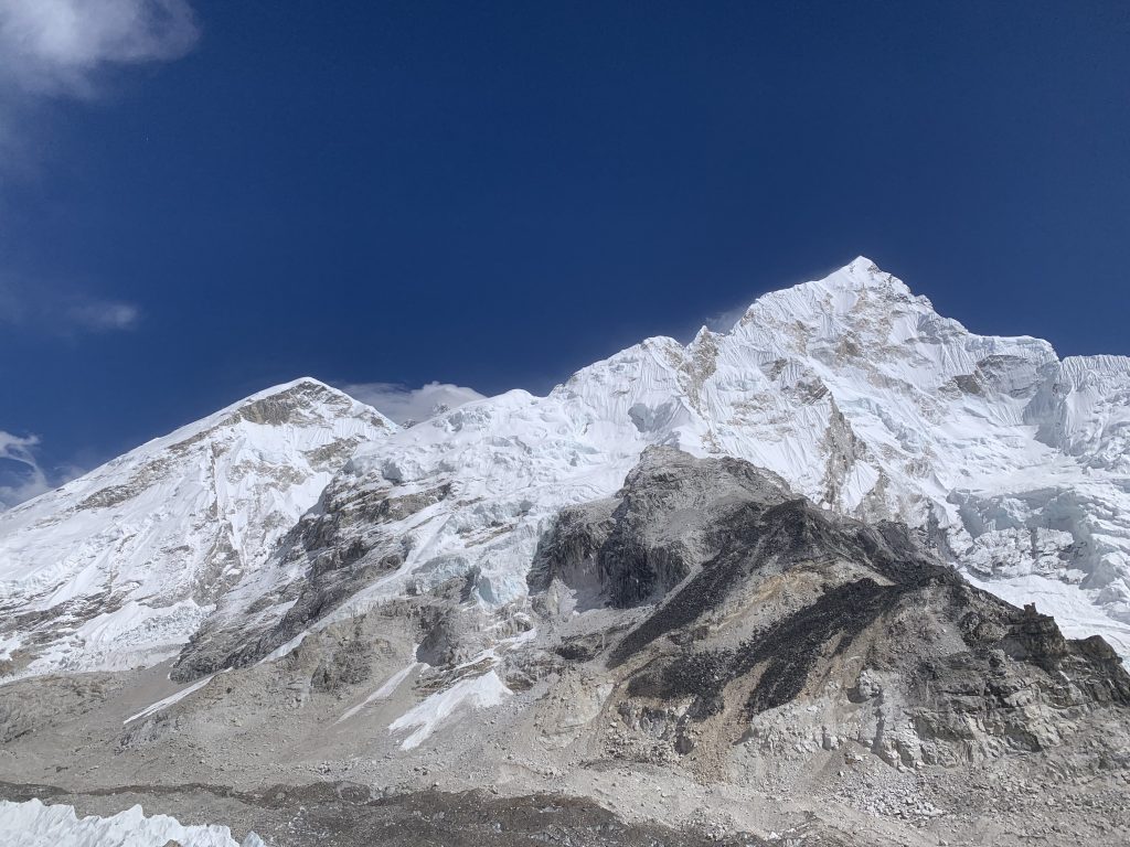
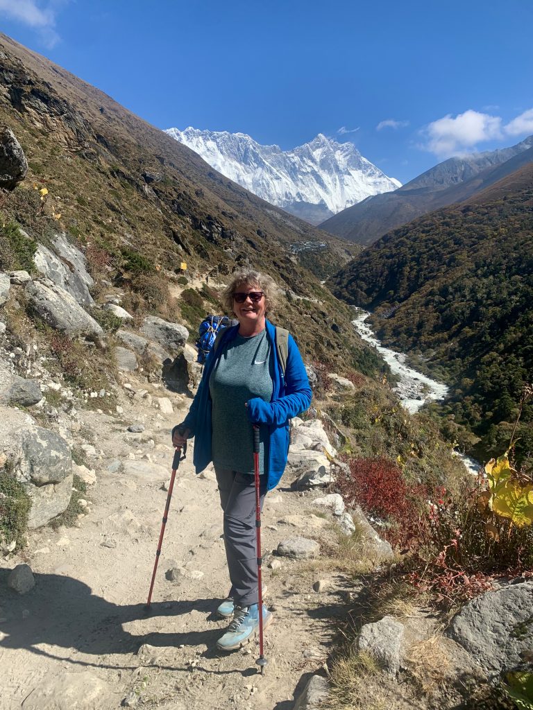
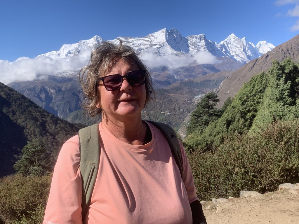
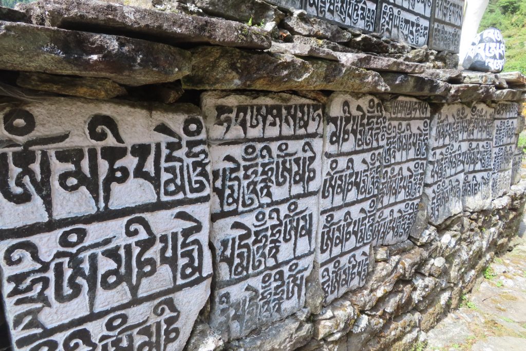
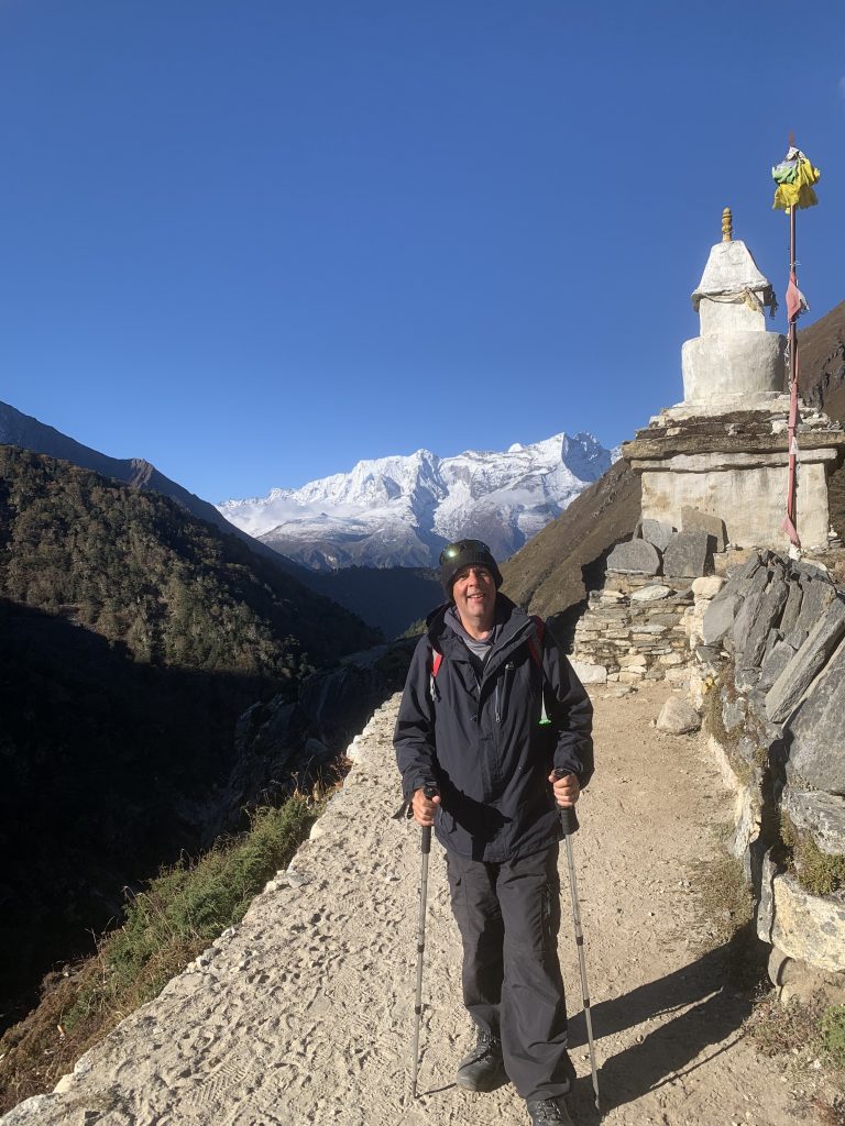
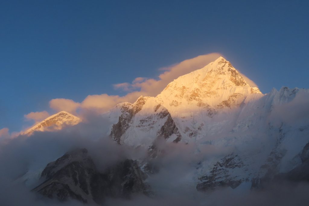
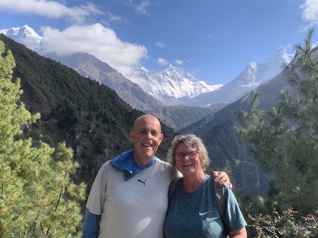
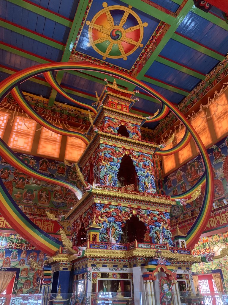
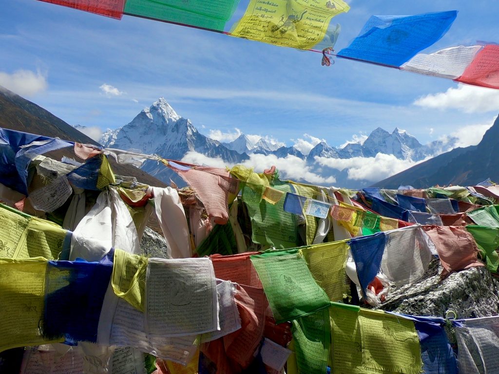
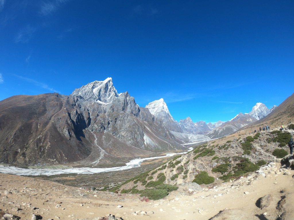
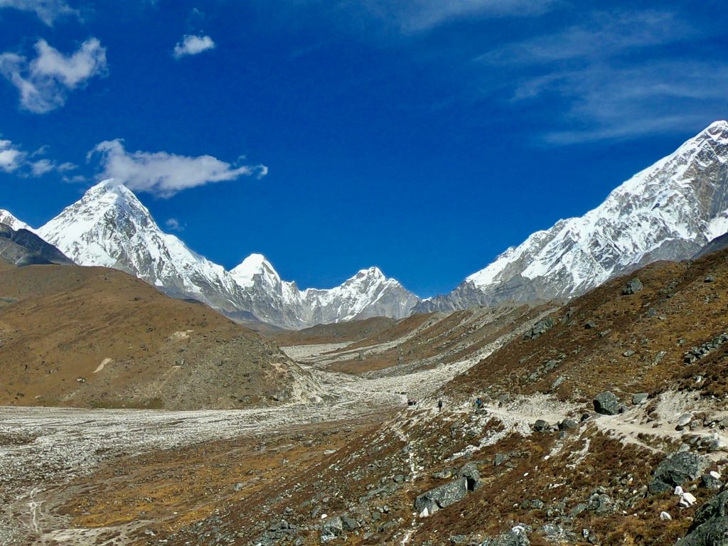
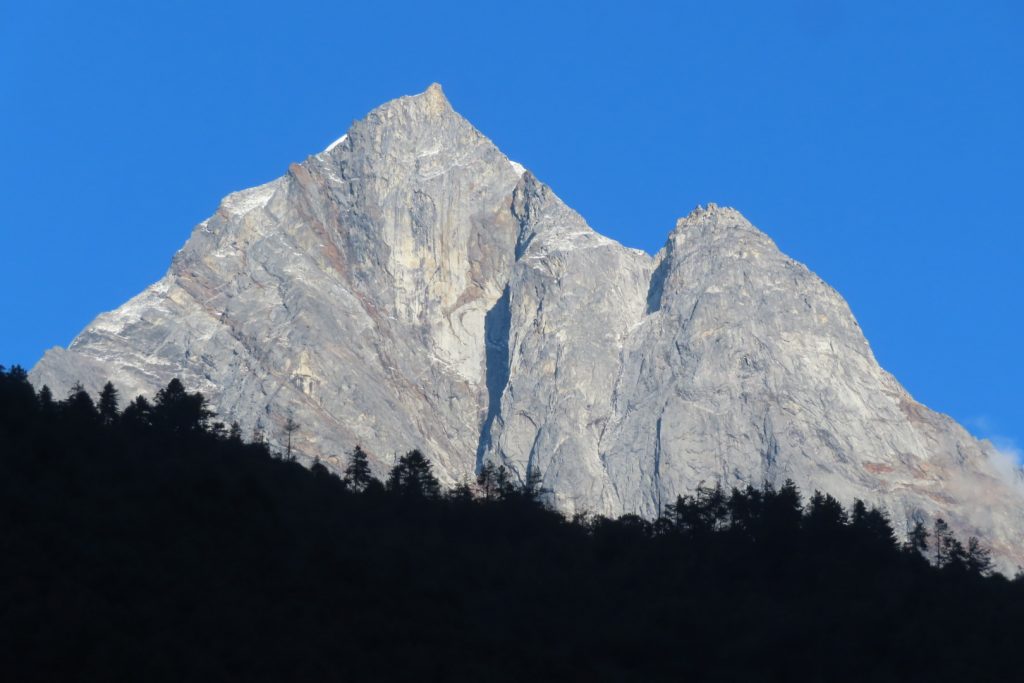
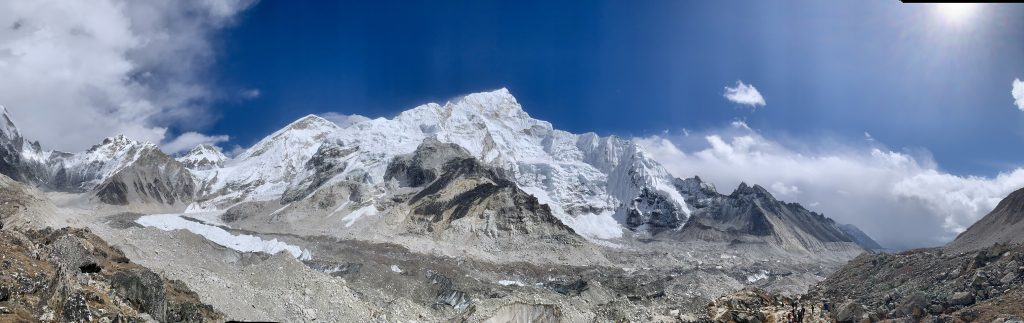
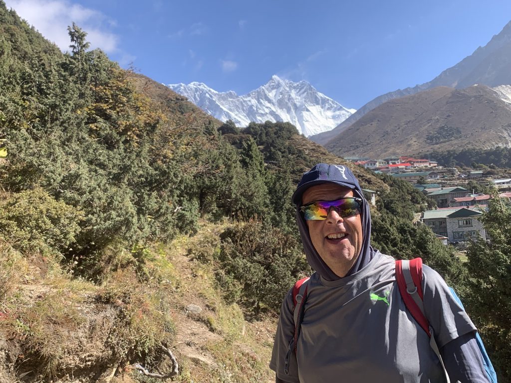
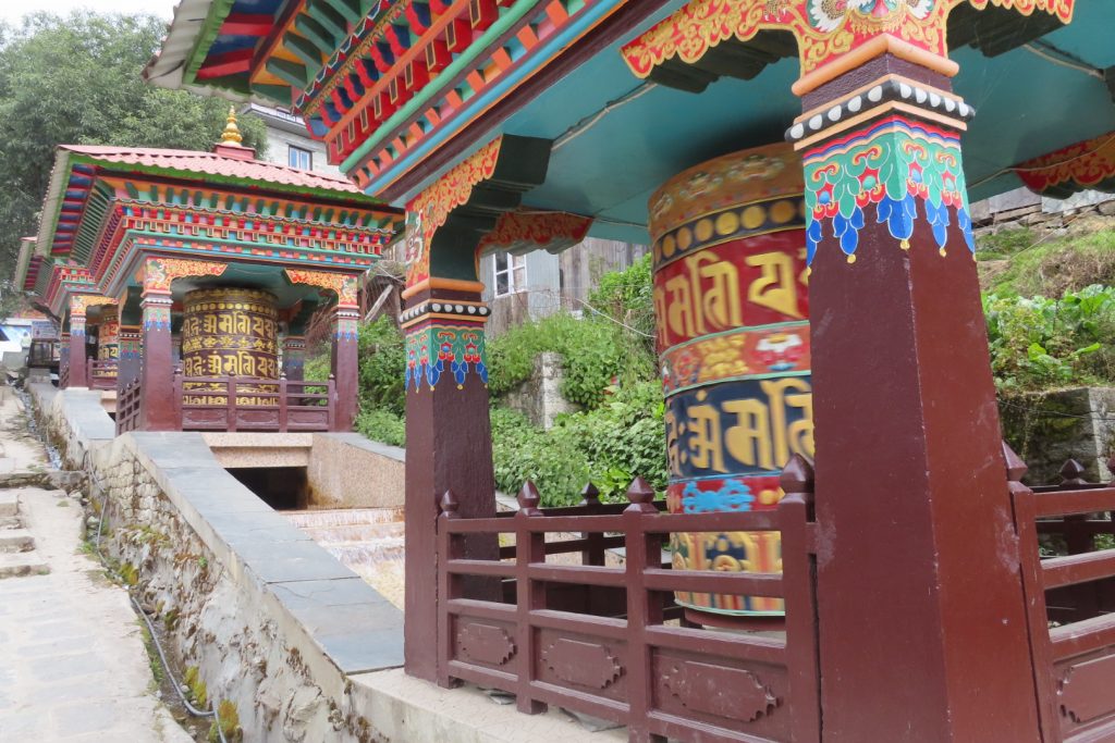
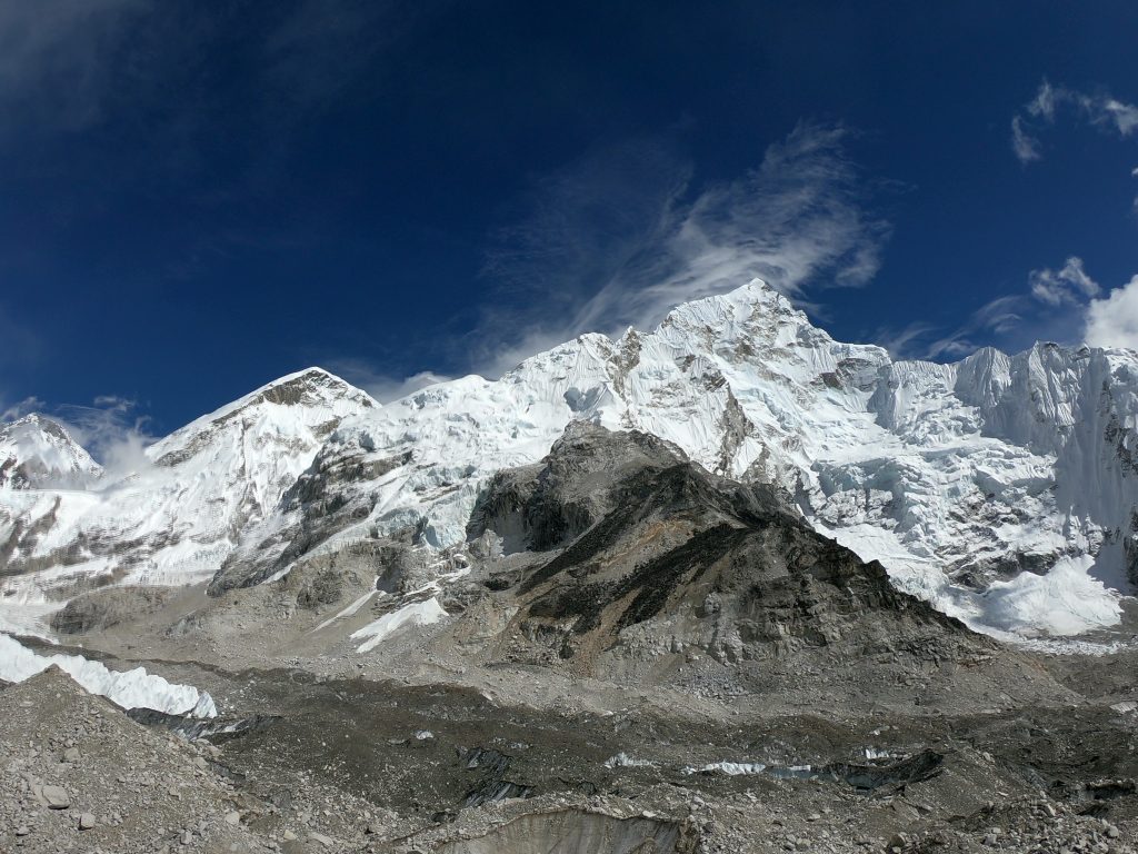
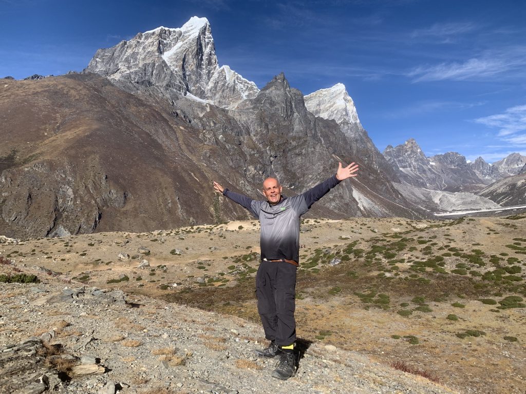
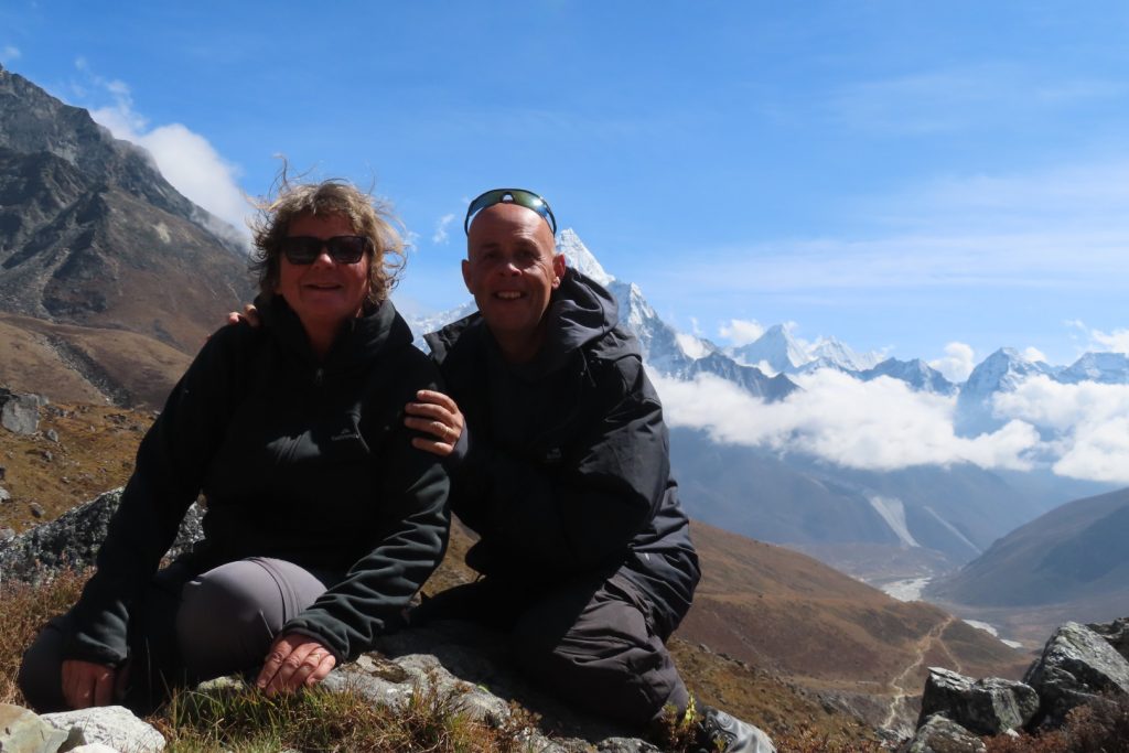
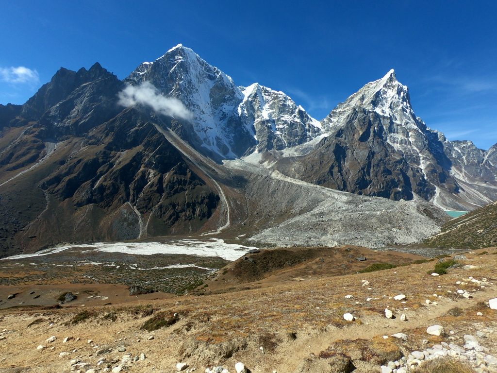
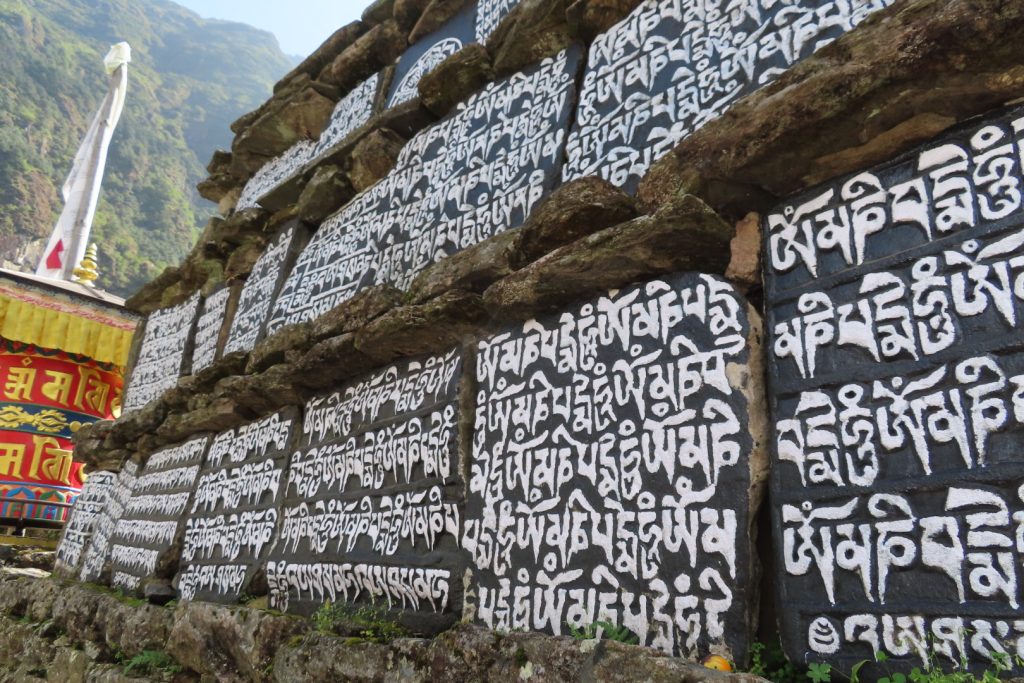
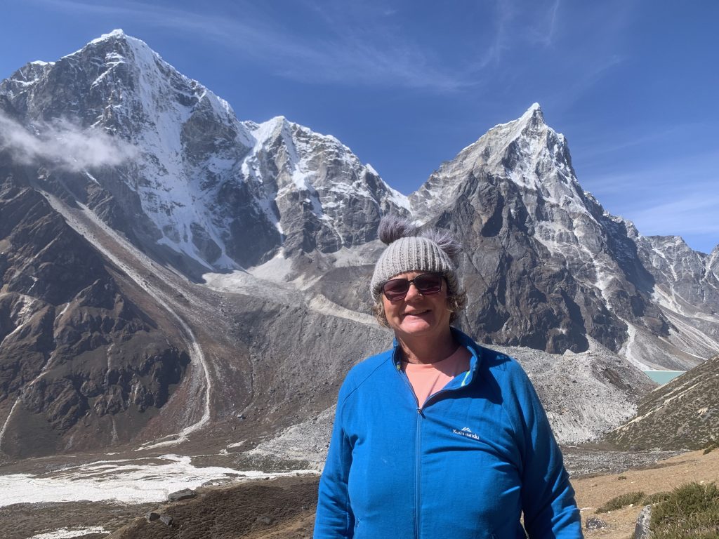
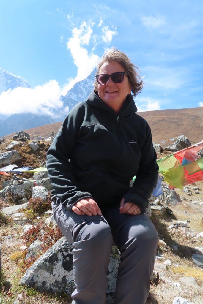
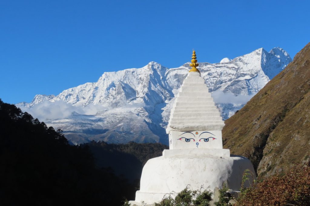
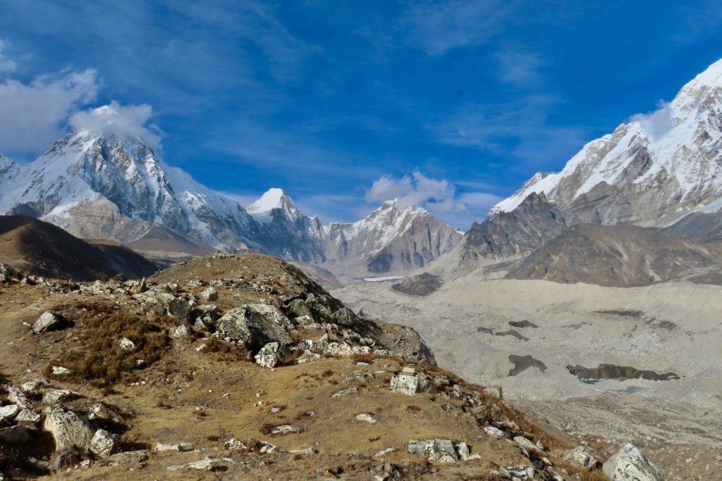
We woke to a freezing start on Day 3, for the hike that would see us rise up to 3,900 meters. During the hike, we had unforgettable views of mountains, including Mount Everest, Nuptse, Lhotse, Cholatse, Kantaiga, Ama Dablam and Thamserku. The initial 3 hour stretch stretch was an easy walk from Namche to Phunki. However, this was followed by a brutal three-hour ascent towards Tengboche, which is home to a traditional Tibetan Buddhist monastery and lots of monks – covering 14.3 kms (22,318 steps) and raising to an altitude of 3,860 metres..
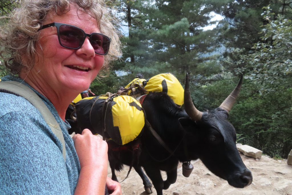
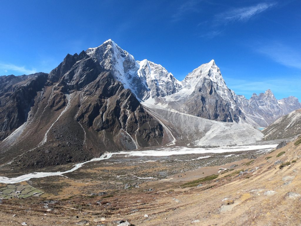
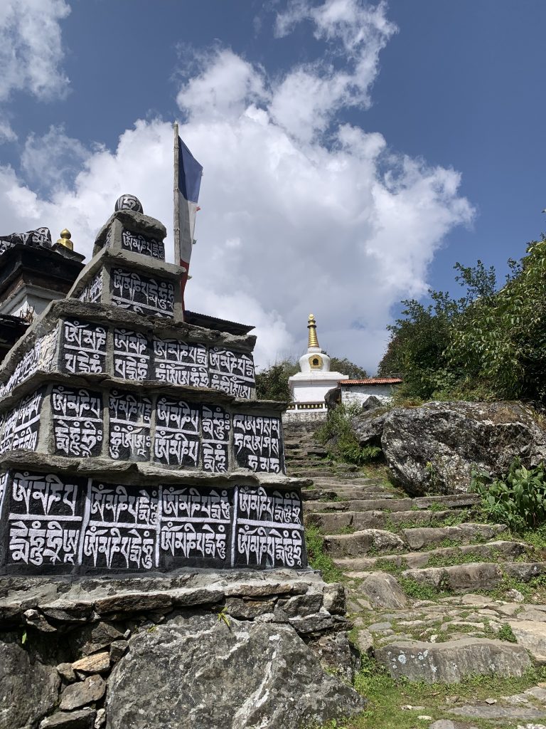
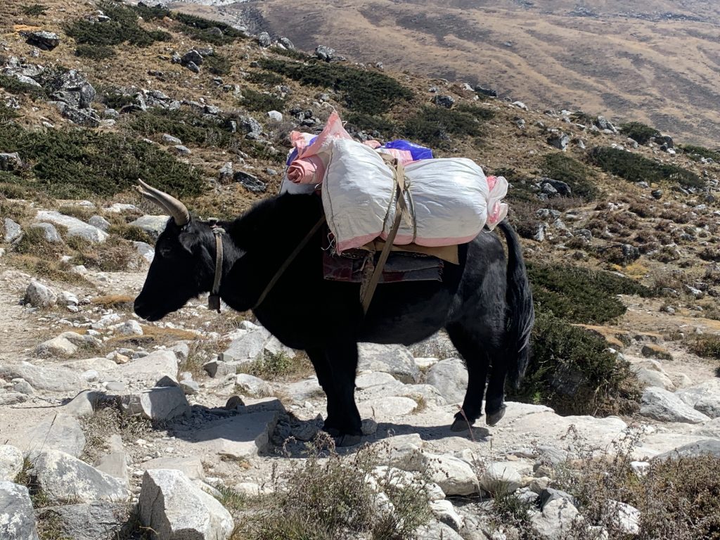
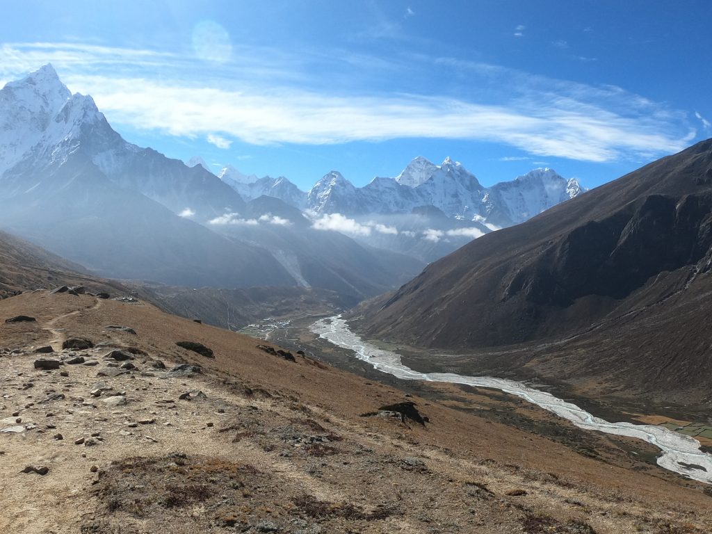
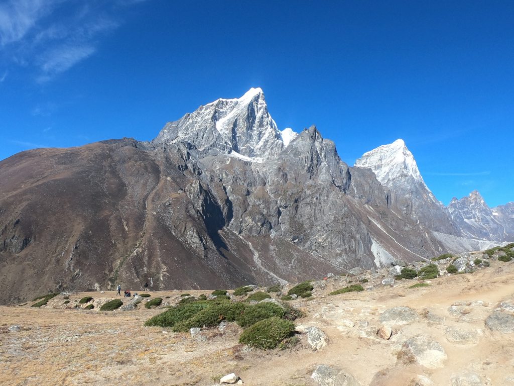
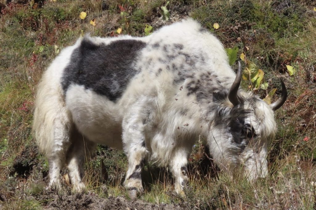
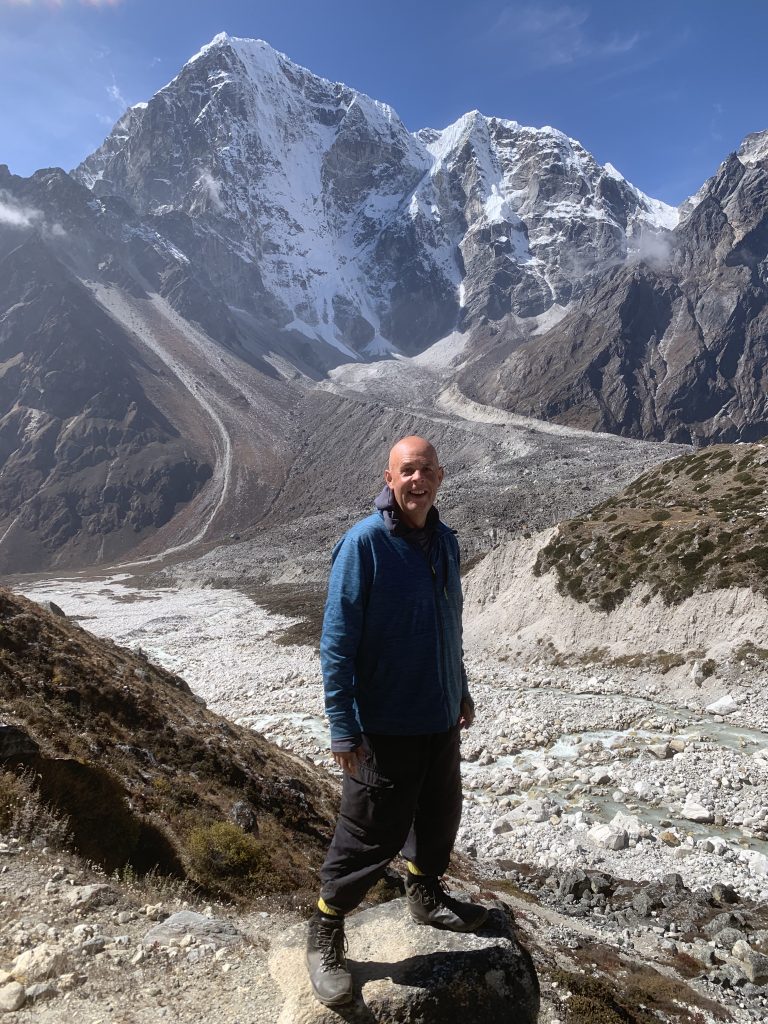
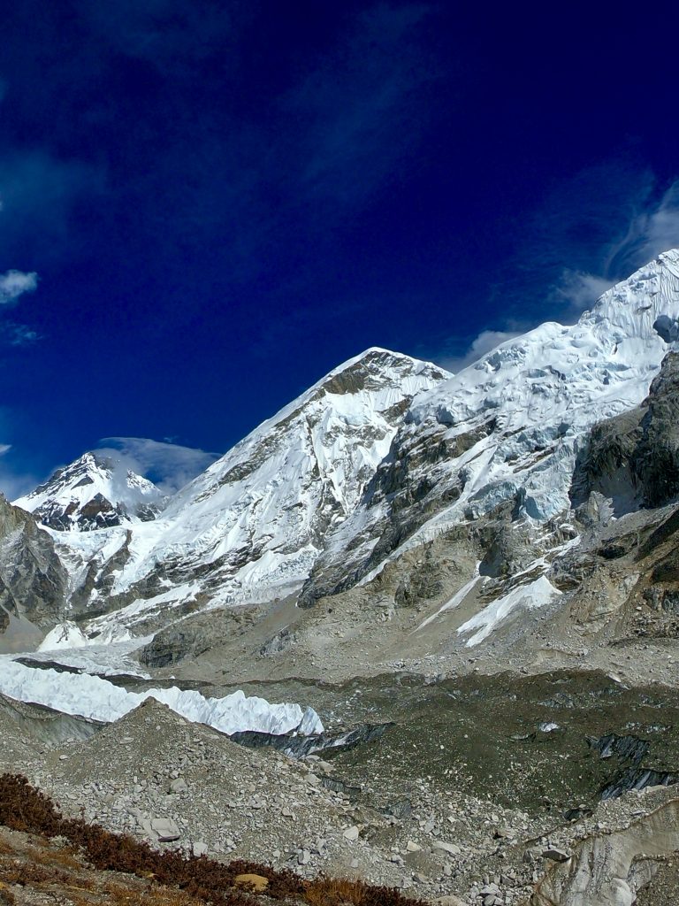
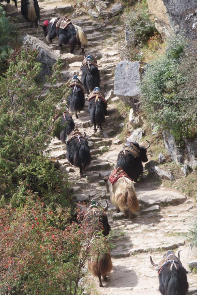
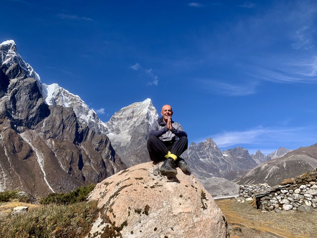
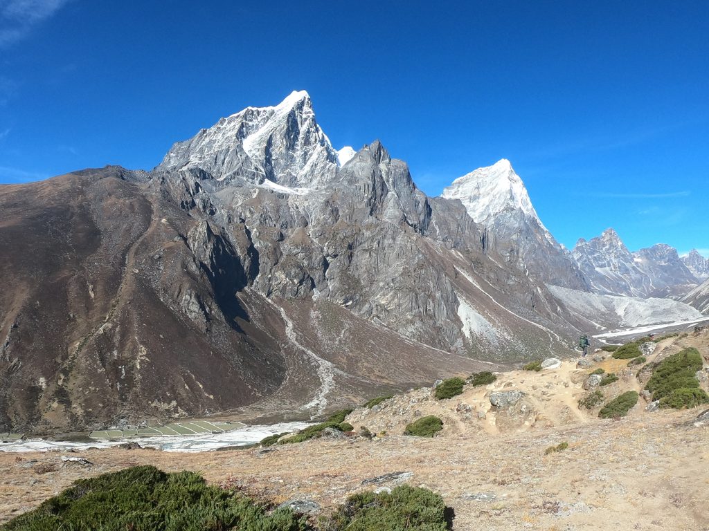
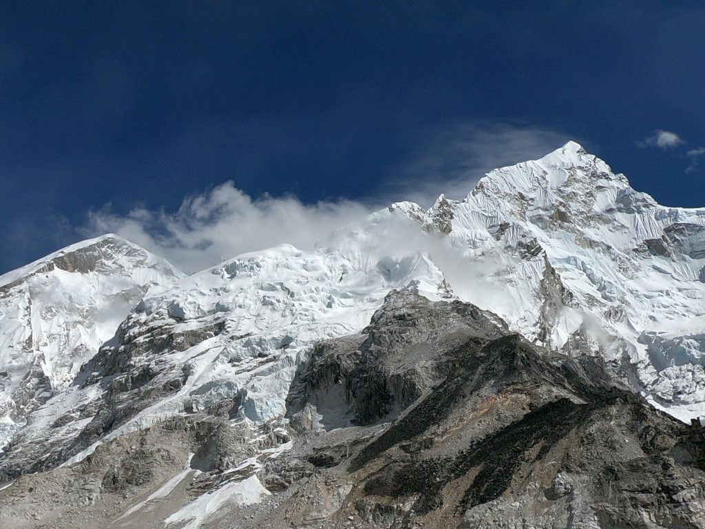
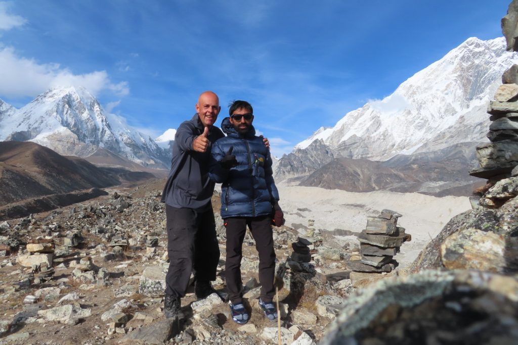
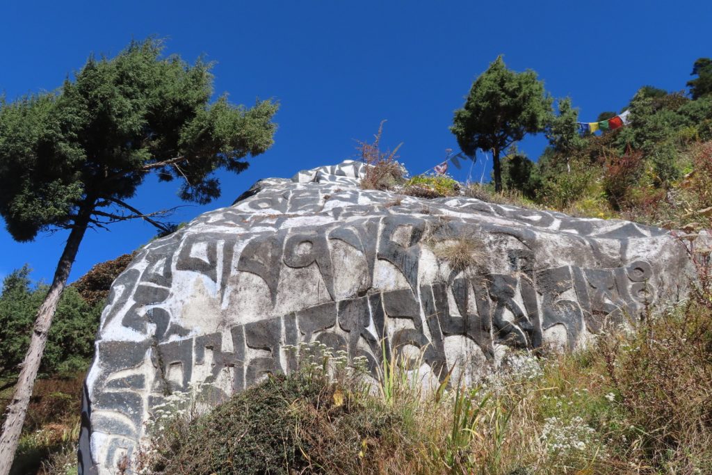
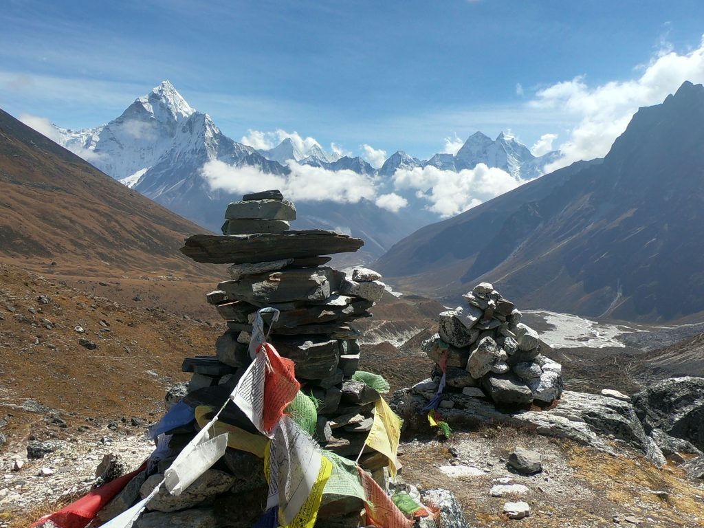
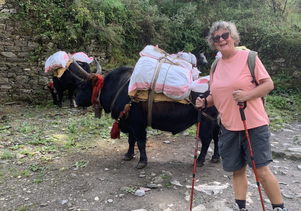
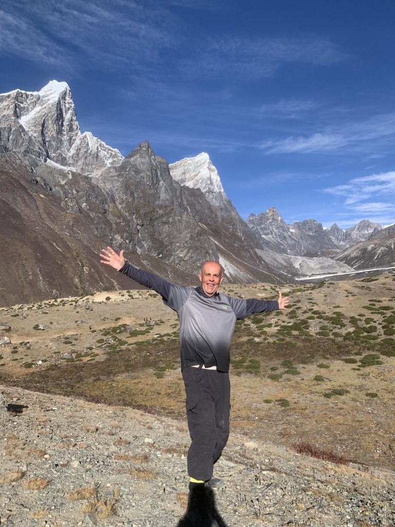
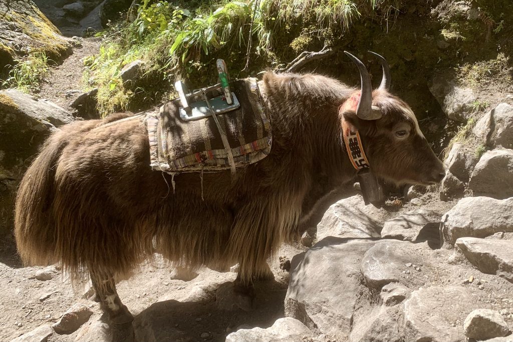
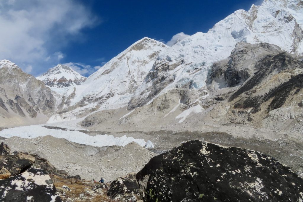
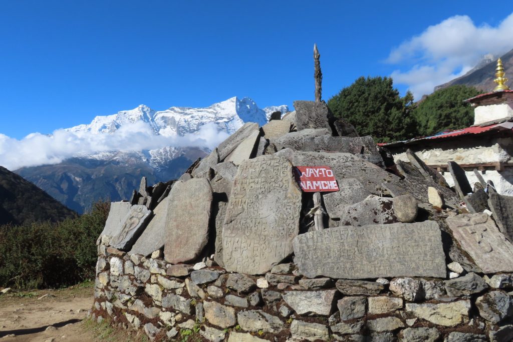
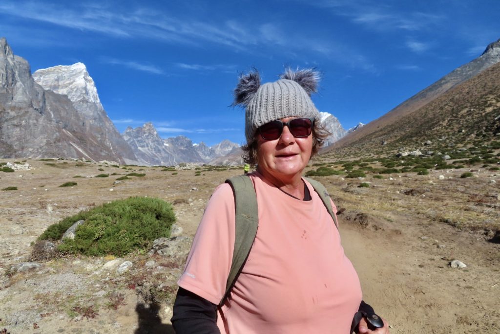
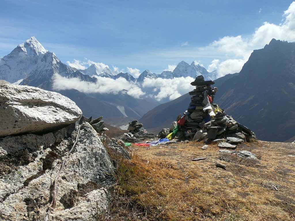
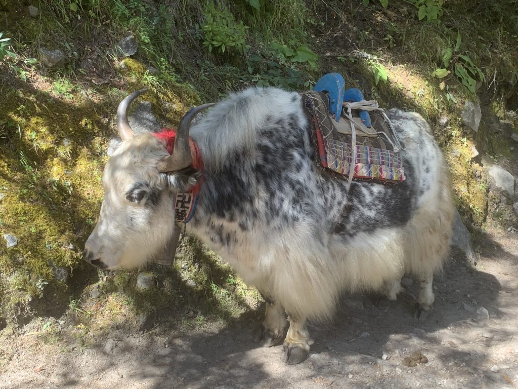
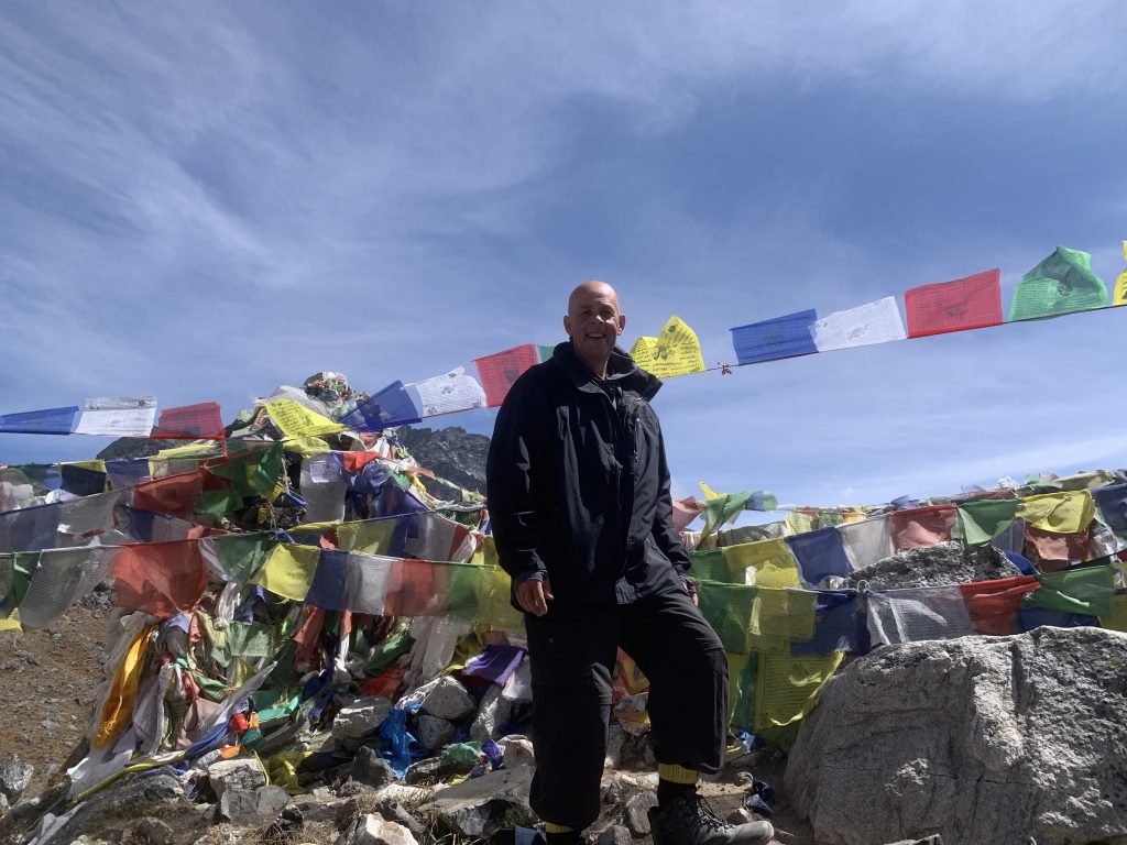
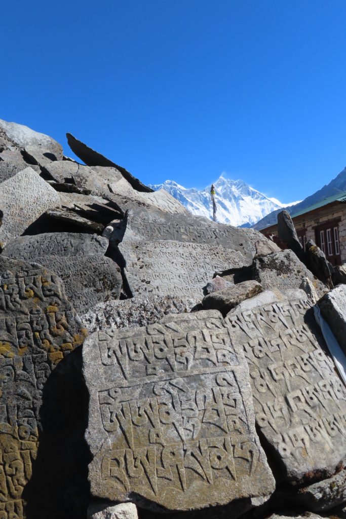
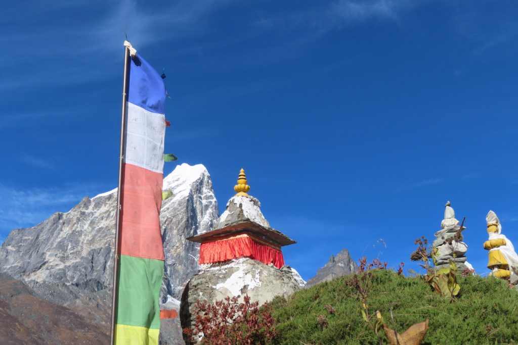
On Days 4 and 5 we continued our hike to Dingboche through forests filled with a variety of lush trees – birch, conifers, and rhododendron and we met a lot of yaks during the day. This picturesque trail dips down to Deboche, crossing the Imja River before climbing up to Dingboche – covering 10.8 kms (16,911 steps) and raising to an altitude of 4,410 metres.. On Day 6 we continued our ascent by climbing for 3-4 hours up to the terminal debris of Khumbu Glacier – crossing the row of stone monuments: established in the memory of six Sherpas who perished as the result of an avalanche. This day was absolutely stunning with almost no clouds in sight, and such a blue sky that made such great photos – even our guide was snapping so many shots – covering 14.0 kms (20,215 steps) and raising to an altitude of 5,050 metres..
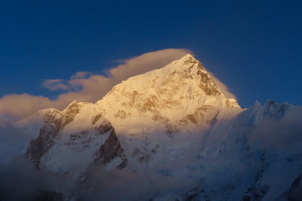
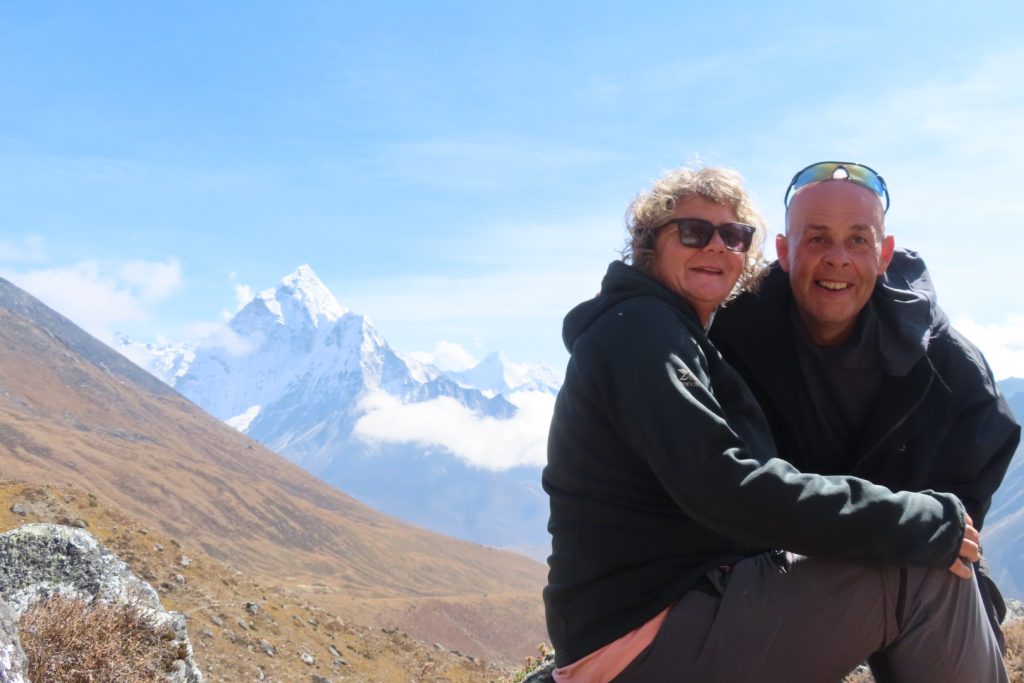
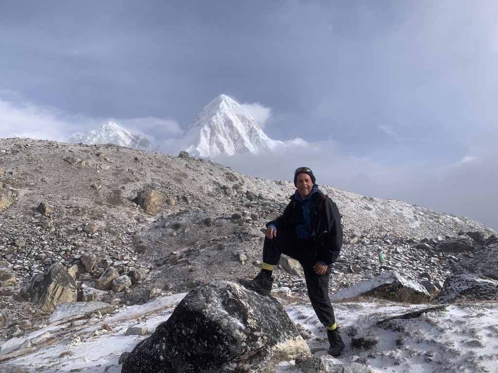
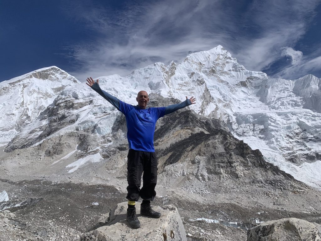
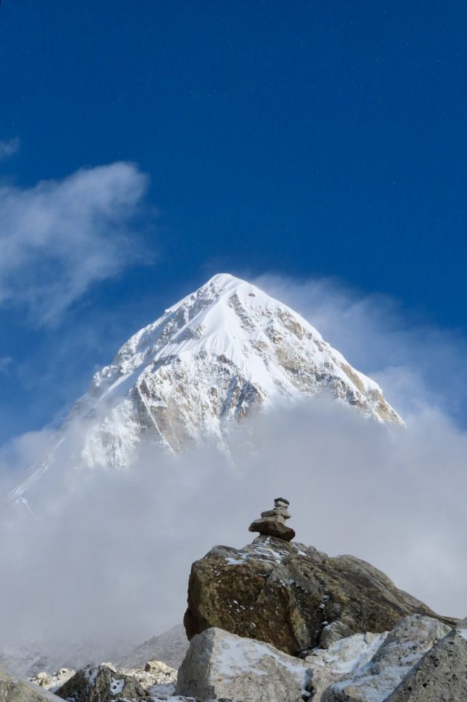
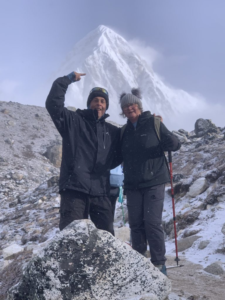
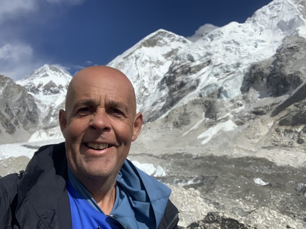
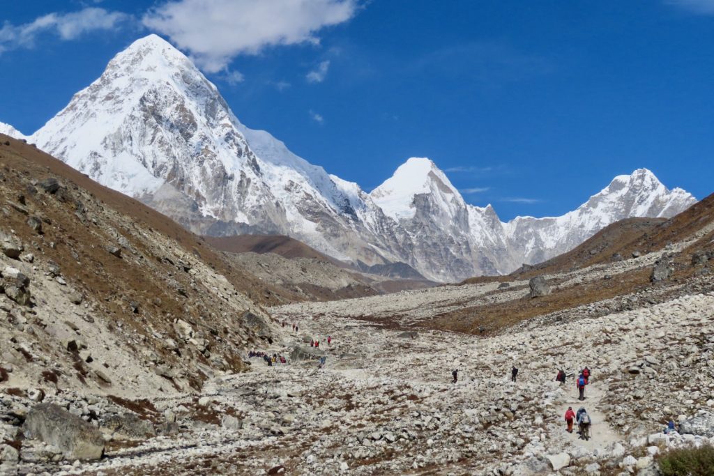
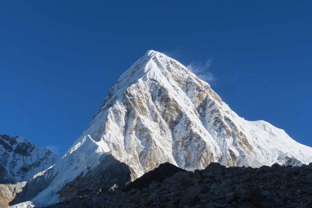
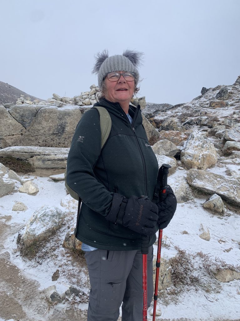
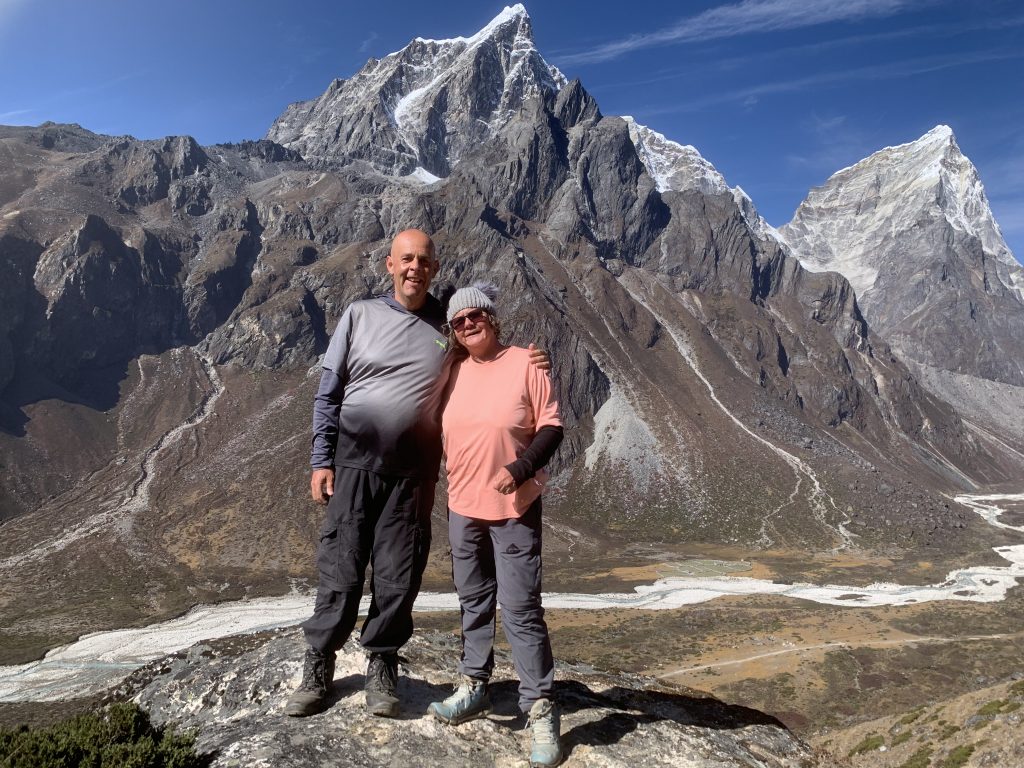
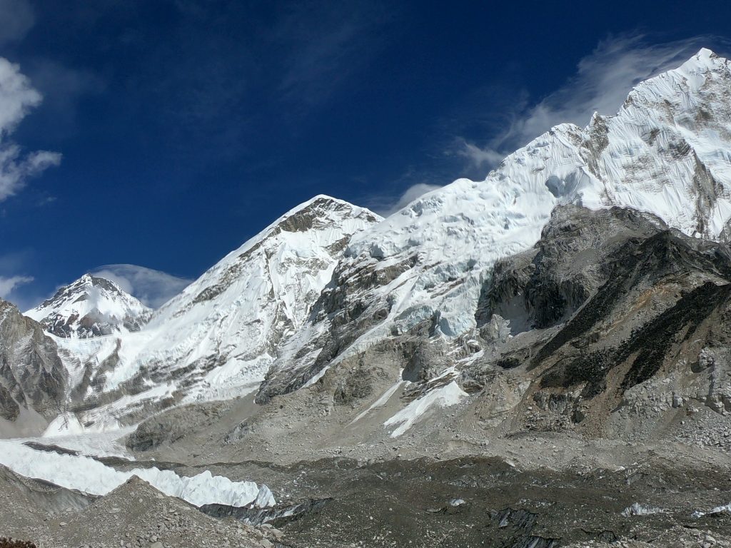
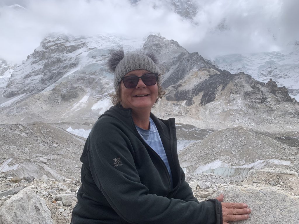
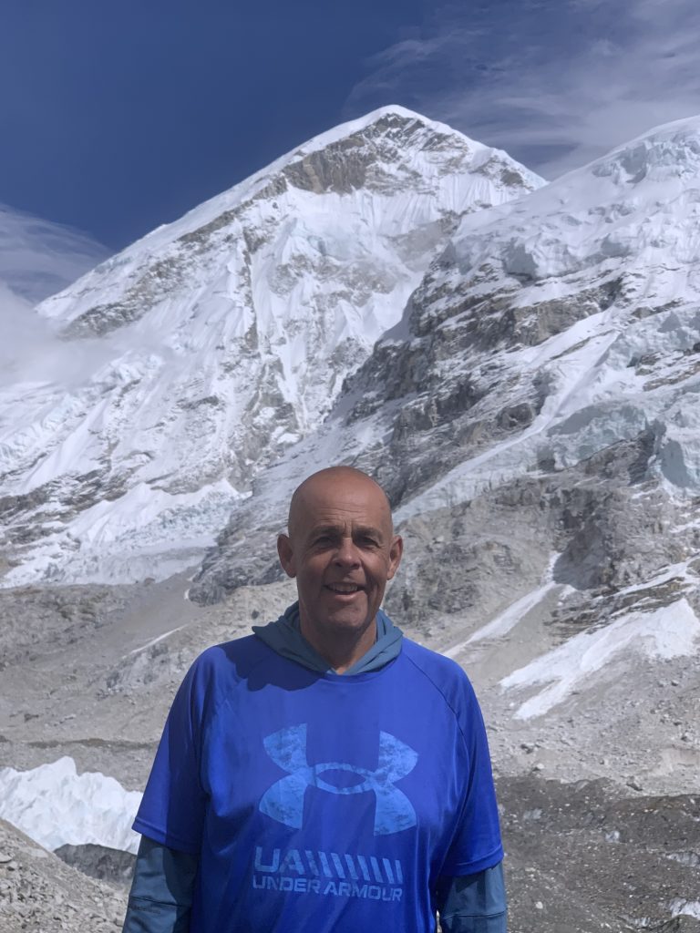
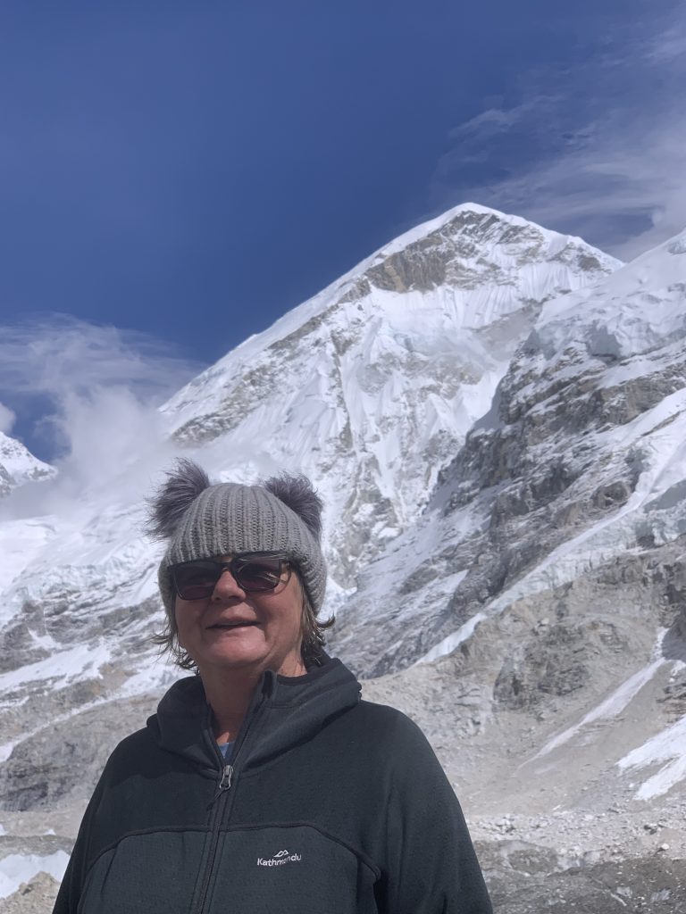
At 0630 on Day 7 we left the Tea House with the temperature recording minus 14 degrees Celsius and light snow falling – this was the day we would reach our ‘goal’. We started our hike early at 0615 and climbed for approximately 2 hours where we enjoyed the best views of Mount Everest and Pumori and other so many Himalayan ranges. After arriving at Gorak Shep, we had lunch and then walked for 4 hours past the Khumbu Glacier to Everest Base Camp – reaching 5,364 metres – which is the closest destination reachable without proper mountain climbing equipment (as it wasn’t climbing season Everest Base Camp is just a barren setting) – we had made it to an altitude of 5,364 metres, seeing some unforgettable views of Everest – AWESOME – covering 10.7 kms (16,460 steps).
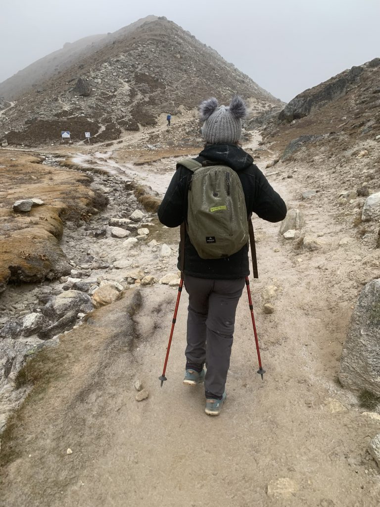
The final 3 days hiking out were really tough. However, on Day 10 at 1600 we reached the exit point for the Sagarmartha National Park, found our Tea House and had our final dinner. Over the 3 days we covered 65.6 kms over the 3 days (23.7 kms – 35,275 steps, 18.0 kms – 28,610 stapes and 23,9 kms – 36,989 steps).
To complete our journey we hurtled down the Lukla Airport https://www.youtube.com/watch?v=R-fg6C0tyg0&feature=youtu.be runway for the short 20 minute flights to Ramechhap Airport – due to the Nepalese festival the 3 hour journey back to Kathmandu ended up taking 7 hours. .
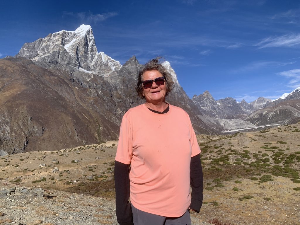
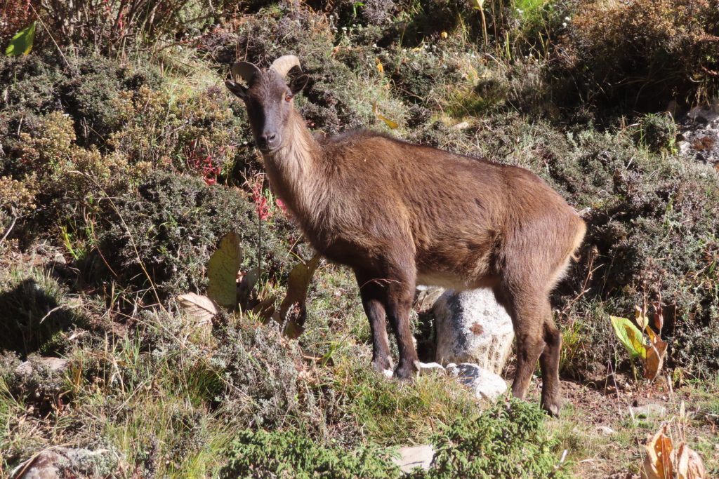
Our final thoughts about hiking in the Himalayas is that it can only be described as awesome – it was an amazing experience that we’ll always remember, although it was very hard going. We are now taking a few days rest in Kathmandu, before we head to some other locations in Nepal – and by the way, Helena’s decided that not only does she like seeing Water Buffalo, but Yaks are also another favourite animal (to both see and eat).


What an accomplishment! Congrats!!
Thank you, legs are a bit sore today – I need a holiday now !!
Congratulaciones 👏👍💪
Thank you, – we are pleased to be back in the warmth, but missing the amazing scvenary.
So awesome!
Than you for taking the time to follow us, we had a great time.
Awesome guys. Once in a life time achievement.
Than you for taking the time to follow us, we had a great time.
I am so impressed and a little jealous!!! It was one of my want to holidays that never happened. Thank you for taking me there in your pictures.
We were so lucky to go, and so very fortunate that the weather was good.
Amazing achievement, and amazing weather for it too. Well done you two.
Thank you, legs are a bit sore – but getting better
Wow what an epic adventure – simply unforgettable. Well done you two!
Thanks Wendy, it’s was definitely an amazing but tiring experience. Now in The final 6 weeks of our trip.
OMG what an amazing experience! Awesome that you both did it. I bet that is a highlight (now that you’re back down 🤣)
We had such an amazing, but tiring time and yes it was definitely one of the highlights – saying that we have had so many over the past 11 months.
Enjoying your journals already! Inspirational. Lovely to meet you both once again. Seb & Kara
Pleased to have met you. Enjoy not only this trip, but also your next one to South America – its amazing.